54 results found with an empty search
- Stage 5 - Teddington Lock to Windsor - 17th June 2024
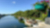
Setting off from Teddington Lock 5th stage of my Thames Sea to Source 2024 challenge on an absolutely belting day. This time 25.49 miles from Teddington Lock to Windsor and Eton Bridge. I don't know what was wrong with my camera but the colours were all over the place today. Refurbishment works going on at Teddington Looking downstream from Teddington Teddington Lock & Weirs Duck enjoying the early morning sunshine Kingston Bridge which the Thames Path crosses over Looking upstream from Kingston Bridge The Long Water at Hampton Court Deer at Hampton Court Golf Club just about staying off the green! The gold Tijou Screen at Hampton Court Palace Hampton Court Palace Hampton Court Bridge - 147 miles to go! Taggs Island - home to one of Britain's largest residential Houseboat communities Quintissentially English Ferry across to Hampton ........and another one! Sunbury Lock Sunbury Lock Heading towards Walton Walton Bridge On D'Oyly Carte Island Nice place to stop for coffee D'Oyly Carte Island The house is being brought back to life The house is being brought back to life The house has 13 bedrooms, a grand ballroom, 5 bathrooms & 40 boat moorings! The ferry connects Weybridge with Shepperton Technology has now made the bell to summon the ferry redundant How many National Trails boast a ferry? On board the ferry On the Shepperton side Looking downstream from Shepperton Lock Pharoah's Island You need a sign this wide for all this information Ryepeck Meadow Chertsey Bridge Chertsey Lock The M3 I always wonder what this is Walking towards Staines Walking towards Staines Penton Hook Lock - the ice cream van always seems to be here Penton Hook Lock Nearly at Staines Reproduction of a London Stone marking the upstream limit of the City of London's authority Bridge 142 has been closed since February 2024 necessitating an unpleasant detour I really like these 2 cottages just beyond Staines Bridge Detour takes you under the M25 and A30 You rejoin the Thames Path at the hotel Bell Weir Lock Walking up to Runnymede Pleasure Ground Queen Elizabeth II Statue at Runnymede commemorating 800th anniversary of the sealing of Magna Carta American Bar Association's memorial at Runnymede The Jurors artwork installed in 2015 commemorating 800th anniversary of the sealing of Magna Carta Walking up to Old Windsor Old Windsor Lock Albert Bridge Datchet The private part of Home Park Windsor Looking upstream from Victoria Bridge Windsor Windsor Castle Romney Lock Romney Lock I got a bit of a shock when I saw this - that's a big swan! After nearly 26 miles I'd earned this pint! Windsor Looking upstream from Windsor & Eaton Bridge Looking downstream towards Romney Lock Journey's End By the time I got home this had been a very long day!
- Stage 6 - Windsor to Henley - 7th May 2024
Setting off from Windsor & Eton Bridge 6th stage of my Thames Sea to Source 2024 challenge on yet another belting day. This time 23.79 miles from Windsor and Eton Bridge to Hanley via the Temple Bridge Closure diversion in Marlow. I did this walk out of sequence in May. It's probably my favourite stage. The Brocas - a large meadow on the Eton side of the river Looking upstream from the Brocas This is as much of Dorney Lake as you can see without leaving the path Dorney Lake Dorney Lake Windsor Marina Oakley Court is a hotel these days Bray Studios Summerleaze Bridge - built as a gravel conveyor belt, taking gravel from the construction of Dorney Lake Summerleaze Bridge - converted to a footbridge on completion of Dorney Lake Bridge under the M4 Bray Lock The rather nice houses of Bray Razor-sharp hedges in outskirts of Maidenhead! Approaching Maidenhead Brunel's Maidenhead Railway Bridge AKA the Sounding Arch Maidenhead Bridge is Grade I listed We cross the river here Maidenhead Bridge Garden One of my favourite views heading towards Boulter's Lock Boulter's Lock. The bridge takes you over to Ray Mill Island - a great place for a coffee break The gardens on Ray Mill Island There are loads of squirrels here Boulter's Lock weirs Weirs at Boulter's Lock The gardens on Ray Mill Island This bridge takes you across to the strip of land between the Thames and the man-made Jubilee River After a coffee break it's back heading towards Cookham How quiet and relaxing this is Spring Cottage on the Cliveden Estate - made infamous by the Profumo Scandal in the early 1960s Another of the Cliveden cottages. You can rent a number of these lovely properties Cookham Holy Trinity Church Cookham We're now walking up towards Bourne End There are some exceptional riverfront properties along here Bourne End Railway & Footbridge. We have to cross the river here View from the bridge Who knew there was such a challenge!! Bourne End has a small marina Heading down towards Marlow Marlow Marlow You have to take this photo of the church & the bridge! Bisham Abbey on the Temple Bridge diversion No pavement or verges so be careful along here You're not getting onto Temple Bridge! Temple Bridge - closed since May 2023 due to safety & structural issues February 2026 - The central span has beee removed for examination February 2026 - The central span has been removed for examination. It's likely the entire bridge will have to come down Looking upstream beyond Temple Bridge Egyptian goose & her family Canade goose & her family White Deer park at Culham Court Culham Court Walking across the Culham Court estate The Flower Pot Aston. It's last owner had an obsession for stuffed fish! The Flower Pot Aston. It's last tenant owned Britain’s largest private collection of cased fish ! Now nearly all gone You have to stop here for a sneaky pint! The new tenants have improved the pubs & the garden no end How posh! The river at Aston Hambleden Weir Hambleden Weir Entrance to Hambleden Lock On the home run into Henley now Preparations underway for Henley Regatta in July Preparations underway for Henley Regatta in July It's 7 o'clock & I've reached Henley Bridge Looking downstream from Henley Bridge Looking upstream from Henley Bridge A long day but what a fabulous walk this has been
- Stage 7 - Henley to Goring - 20th June 2024
The Thames Path gets diverted almost straight away at Marsh Lock Stage 7 of my 2024 Thames Path challenge to walk from the sea at Grain to the Source near Kemble in 11 stages. 20.57 miles today from Henley to Goring. It was an absolute perfect day, spoilt only by a 35 min delay getting the train back to Henley where my car was parked. Loved the warm sunshine at last. Will have to expose my white knees on the next stage! The Marsh Lock closure results in a long diversion that takes you through Harpsden Wood in order to reach Lower Shiplake. I chose to avoid this by walking along the (admittedly) busy A4155 Reading Road. My map of the walk shows shows this route rather than the official diversion. For most of the way, the A4155 is fine; for about 200 yards however, the grass verge disappears and you're forced to walk on the road. This is why the bridge is only partially open - the structure beyond the lock is unsafe Weir gates at Marsh Lock This part from Henley is open as far as the lock Official diversion in blue. The main road route shown in red This is the main road by the Bremont watch factory. The verge here is plenty wide enough OK so the verge disappears briefly Walk along here into Lower Shiplake Lower Shiplake Shiplake Lock Shiplake Lock Shiplake Lock The river by Shiplake College's boathouse Looking back downstream towards Shiplake This is a quiet section of the river Approaching Sonning Bridge Sonning Bridge The Thames Path crosses the river at Sonning Sonning Lock The ducks, geese and swans really enjoy relaxing here in Thames Valley Park Nature Reserve - a former power station Approaching Reading Reading Caversham Lock Reading Hydro uses the power of the weir at Caversham Lock Caversham weir Caversham Lock Reading Bridge Christchurch Bridge Looking up towards Caverhsam Bridge Another popular place in Reading for swans This is a lovely footpath up from Reading City Centre Gorgeous in summer for relaxing I always have to take a photo of the this house! Lara Croft has lost her arm since I passed here last year! The path passes this rather well to do housing estate - Purley-on-Thames Mapledurham Lock In autumn especially, Mapledurham Lock to Goring is one of my favourite stages with the backdrop of all the trees of the Chiltern Hills. Mapledurham Lock What a lovely backdrop This is a lovely meadow to be walking across I've reached Pangbourne Meadow Looking back downstream towards Mapledurham Whitchurch Bridge connecting Pangbourne with Whitchurch Whitchurch Bridge - one of two private toll bridges crossing the Thames. Swinford Bridge is the other one. Looking back from Whitchurch Whitchurch - so pretty Hartley Steps in Hartslock Wood. The only bit of hill climbing on the Thames Path Glimpses of the river from up above in the woods Pill box in Hartslock Wood Gatehampton Railway Bridge near Goring Gatehampton Railway Bridge Approaching Goring Yay! Reached Goring Goring Lock I've earned this pint! Goring Now need to get the train back to Henley Back in Henley at 8:15 - 12 hours after setting off this morning Another long walk
- Stage 8 - Goring to Abingdon via The Ridgeway - 24th June 2024
Goring Lock Stage 8 of my 2024 Thames Path challenge to walk from the sea at Grain to the Source near Kemble in 11 stages. 20.55 miles today from Goring to Abingdon. I decided to avoid having to walk along the busy main road through Moulsford and Cholsey Nature Reserve by instead walking The Ridgeway route on the other side of the river between Goring and Wallingford. I would then cross back to the Thames Path over the Winterbrook Bridge. Makes for an altogether much more pleasant walk. Thames Road on the Goring side of the Streatley-Goring Bridge over the river Thames Path is on the other side of the river. I'm on The Ridgeway The Perch & Pike in the pretty village of South Stoke Back by the river - the Beetle & Wedge on the other side where you would leave the path for the busy road in Moulsford You don't see this from the Thames Path Moulsford Railway Bridge from another angle Looking upstream beyond Moulsford Bridge Cholsey Nature Reserve is off to the right and left. At one time there was a ferry here Path leaves the river briefly, heading for North Stoke North Stoke North Stoke The river from Winterbrook Bridge Now back on the official Thames Path at Wallingford Heading towards the town centre Market Place Wallingford Looking upstream from Wallingford Bridge Looking downstream from Wallingford Bridge Whilst the walkway over the weir is closed for repairs, this brilliant ferry service at Benson has stepped in to save walking the detour On the ferry! Coffee & raspberry ripple cake! A staple of mine at Benson Waterfront Cafe Works going on, rebuilding part of the bank Very neat! Shillingford Bridge This is a bridge over the Thame near Dorchester. It's where the Thame meets the Thames! Little Wittenham Bridge. The bridge continues behind the lock keeper's cottage Day's Lock with the Wittenham Clumps in the background Day's Lock & The Clumps Looking upstream from the other side of the weir Day's Lock & Weir - so pretty You get a lot of wildlife along here The Earth Trust has been responsible for projects creating new backwaters along this stage, encouraging more wild life One of the new ponds - thanks to the Earth Trust So pretty! Clifton Hampden Bridge - unusually for the Thames, built from red brick A group of walkers I met at Clifton Lock Clifton Lock - Every year, Curtis & his wife add more colour with profits on ice cream sales adding to their plant kitty I encourage you to buy an ice cream as the profits go to a good cause - more plants! Clifton Lock - just perfect! The Cherwell Valley Line operates on these tracks between Didcot Parkway & Banbury Culham Lock After the final major bend in the river today, Abingdon is in the background St Helen's Church Abingdon Abingdon Bridge Well earned pint at the Nag's Head
- Stage 14 - Cliffe to Grain - August 22nd
I had my full English at the Premier Inn and took 3 pain au chocolat and a banana to keep me going through the day. I checked out but left my luggage which I would collect at the end of the day. I caught the 170 bus into Strood and then caught the 133 back to The Six Bells at Cliffe. With no recovery time after yesterday’s walk from Greenhithe to Cliffe, I was slightly concerned about how my foot would cope with this final stage of my walking challenge but it felt OK right now. From Cliffe it was necessary to retrace my steps through RSPB Cliffe Pools until I reached Cliffe Creek. Yesterday I had walked down the left hand side of the creek from Cliffe Fort to get to Cliffe. Today I had to walk up the right hand side of the creek to be able to continue towards Grain. From this point on, for the next 12 miles I would be completely on my own, walking alongside the sea wall most of the way. The landscape is flat marshland and saltings. On a cold and wet winter’s day I would imagine the landscape would be pretty bleak but on a mild sunny day like today it was lovely. The land is so flat that you can see for miles. The container cranes of DP World London Gateway Port dominated the Essex side of the river all day. One thing I didn’t appreciate until after I’d walked this section in 2022 was the reason for an apparent deviation from the natural course of the river starting at the point where a misspelled sign told me to bear right. It turns out that when DP Ports were constructing London Gateway Port, they (presumably?) paid for the creation of a new reserve called the Salt Fleet Flats Reserve as compensation for predicted impacts to coastal habitats resulting form the new port. The tide was allowed to flow into the new reserve by removing 700 metres of sea wall. The things you learn! After passing Egypt Bay beach I came face to face with a solitary cow. This was the first and only creature I would pass in 12 miles, let alone any human beings! Another couple of miles further on and the Allhallows Holiday Park came into view in the distance but was still 3 miles away. Approaching Allhallows, the path turned away from the river and continued along farmland briefly before emerging at the holiday park. I don’t mind admitting that I found that 12 miles from Cliffe to Allhallows a real slog. Maybe it’s because I was tired after yesterday’s walk, plus my foot was starting to hurt. Last year I walked this section at the end of April and the holiday park was like a ghost town with everything shut. Today however, it was buzzing with holidaymakers and I was so pleased. That’s because I’d run out of water and the onsite bar/café by the sea was open. The very kind lady behind the bar filled my bottle with ice cold water. After eating my banana from breakfast I set off again on the final 5 mile stretch of my challenge to Grain. The holiday park extends for quite a way but eventually the path had a more familiar look to it – flat marshland. After another mile I reached Yantlet Creek. Yantlet Creek is the reason for the Isle of Grain. At one time the creek stretched from the Thames to the Medway and the land to the right was a true island – hence the Isle of Grain. However, the creek was forever silting up and nowadays it’s only about 1½ miles long with sea walls preventing it from getting any further. Turning right down Yantlet Creek the storage tanks of Grain LNG - Liquified Natural Gas – came into view. I don’t care how ugly they are but right now they were beautiful to me as I was nearly home and dry. At the sea wall, rather than continuing up the right hand side of Yantlet Creek and round into Grain, the path instead heads straight for Grain. Yipee! This is because the land to the right of the creek was requisitioned by the War Office in the 1920s to be used for artillery trials and practice firing across the Thames Estuary towards (but not into!) Shoeburyness. The military have been long gone but there are still plenty of signs telling you to keep out. I gratefully did as I was told. At last I reached Grain itself and headed towards the beach which would be the official end of my challenge. I passed the Co-Op on the way down to the beach and bought 4 cans of cold beer (couldn’t buy just 1). Despite my foot really hurting, I managed to put on a spurt to the beach for the benefit of my drone. The sense of achievement at reaching Grain in 14 stages and with a dodgy foot was immense; far greater than for any other walk I’ve done. Maybe it was that final walk down to the sunny beach at Grain, or the fact that I hadn’t let the people who sponsored me down – probably a combination of both. I didn’t have too much time to contemplate this as the 191 buses from Grain are few and far between. The pub in Grain is almost opposite the bus stop. I had just about enough time to down a sneaky pint before the bus came. Back in Strood, I treated myself to a taxi to take me to the Premier Inn for my luggage and then bring me back to the station. I then got the train to St Pancras and by the time I got there it was about 8:15. I wasn’t that hungry for an evening meal but what I really fancied was a Greggs sausage roll; in fact 2 Greggs sausage rolls – a ‘real’ one and my first ever vegan one. I have to say I preferred the vegan one!! I got the train back to Huntingdon and then drove home. It was gone 10:30 by the time I got home and I was still buzzing with the sense of achievement; in fact, I was on such a high that I hardly slept a wink thinking about what I’d done. I have one more blog post to write which I think I’ll call “and finally”. For now, I just want to say a huge “Thank you” on behalf of myself & Royal Papworth Hospital Charity to everyone who sponsored me.
- Stage 13 - Greenhithe to Cliffe - August 21st
For stages 13 and 14 it would be necessary to stay away as it would be totally impractical to commute from home. When I did this walk last year I stayed at the Rochester Premier Inn. This is actually in Strood on the other side of the Medway! I chose this for a number of reasons – · I wouldn’t need to drive other than to and from my local station at Huntingdon · Strood has a railway station · the high speed train service from St Pancras – HS1 – takes 34 minutes to get to Strood · being on a bus route, the Premier Inn is easy to get to from the station · Strood has the bus links to both Cliffe and Grain · Premier Inn breakfasts start at 6:30. Really handy for getting an early start. · Premier Inns offer a left luggage service unlike Travelodge. Left luggage services like LuggageHero don’t extend this far out of London. After checking out of the hotel, being able to safely leave my luggage for the day whilst out walking would be vital. · I really like Premier Inns! Had it not been for the lack of left luggage service, the Rochester Travelodge would have won! Having stayed at this Premier Inn last year it was a no-brainer for this year. Its rooms overlook the River Medway and for a nerd like me who loves bridges, there is the Medway Viaduct just a couple of hundred yards away. The Medway Viaduct has two road bridges carrying the M2 over the Medway and a third carrying the HS1lines over the river. A new UK railway speed record of 208mph was achieved by a Eurostar train in 2003, as it crossed this bridge – so there! So, after getting home from my stage 12 walk to Greenhithe on Saturday, I set off again on Sunday lunchtime for Strood and checked into the Premier Inn mid-afternoon. As requested, I had a room overlooking the Medway and of course the bridges! On Monday morning I was down early for breakfast. I sneaked out a couple of pain au chocolat for a planned mid-morning snack in Gravesend. I got the 170 bus to Strood Station, caught the train to Greenhithe and by 8:15 I was back on the path. The morning started like my Saturday walk from Woolwich – very grey and overcast. Despite the greyness, the QE11 Bridge still looked amazing The path briefly left the river and took to the streets of Greenhithe. Very soon the houses and apartment blocks came to an end and I was walking along Swanscombe Marshes towards one of today’s highlights – the 400 kV Thames Crossing! Unless you are blind it’s totally impossible to miss the 2 pylons that carry 400 kV power lines across the river to West Thurrock; they can be seen for miles around. The pylons are the tallest electricity pylons in the UK at 190 metres. To give you an idea of scale, the BT Tower in London is 189 metres high. Best of all, the ECP takes you right under the Swanscombe pylon! It’s amazing standing under it, admiring the construction of this beast; bit of a shame that it was so grey though. The path doesn’t go the tip of the Swanscombe Peninsula and walkers are given a stern warning not to attempt this. I did as I was told and followed the signs for the path across Botany Marshes before exiting into an industrial estate in Northfleet. After passing Ebbsfleet United’s ground, the signs directed me back towards the river. I remember from last year that the path passed through some pretty run-down industrial areas in Northfleet and it was the same this year. Eventually however I emerged into an industrial estate that was a little less threatening let’s say. The estate was dominated by Kimberley-Clark where they make Andrex loo rolls and a huge Lidl distribution centre. Last year it hadn’t been possible to continue straight on after Lidl and there had been a longish diversion through the streets of Northfleet. The diversion was in place as groundworks were being carried out for a large new housing development called Cable Wharf. This year I could see some houses had been built and there were ECP signs directing me through the estate. “ECP signs” is actually a bit of an exaggeration; “ECP sign” is the truth of it. I was very pleased not to be diverted, so happily and innocently followed the sign. All was going well initially but very soon I was well and truly on my own, walking alongside an active building site with no barriers in place. I was sure this couldn’t be right because eventually I came to a dead end. A couple of builders even asked me why I wasn’t wearing a hard hat! I turned back to find a different route through the site and eventually came to some barriers with ‘Pedestrian route’ printed on a sheet of paper. However, these too came to a dead end. Eventually a site foreman came up to me and asked me how I’d got to where I was. He told me that I should have been stopped by a gateman long before I entered the building site. He kindly escorted me off the site and I emerged where I hoped I would be. I was now in Gravesend on a path by the side of the river and all was well again. There was even a glimmer of blue sky. One of Gravesend’s points of interest is the statue of Pocahontas in St George’s Churchyard. It’s only a very short distance to deviate so I decided to take a look. The statue commemorates the life of a Native American woman known in popular culture as Pocahontas. She converted to Christianity and married an Englishman. They came over to England for a stay in 1616. To cut a long story short, on their way back to America in March 1917 she got ill and aged 22, died in Gravesend. She is believed to have been buried in St George’s Church. History lesson over. Anyway, whilst I was taking photos of the statue, a group of Gravesend residents waited patiently for me to move. They noticed the Papworth logo on my t-shirt and next thing you know, one of the ladies took out £5 from her purse and handed it to me as a donation. I didn’t get any of their names but whoever you are, thank you very much! Back on the path I was now by the riverside again. After passing the elegant pier and lightship LV21 I reached Gravesend Promenade and more importantly, the Promenade Café. It was 11 o’clock and time for a coffee and the pain au chocolat from breakfast. I do love the Promenade Café. There is something rather seasidy about it. If nothing else they have the largest number of pavement signs I think I’ve ever seen! As well as my hot drink I ordered a sandwich that I would eat later on, bearing in mind there would be nowhere to get any food between here and the end of my walk. Right on cue, the clouds were really breaking up now. From the promenade I followed the same diversion I walked last year that went through one of Gravesend’s industrial estates. Once back by the river I was happy as Larry. The section from this side of Gravesend to Cliffe Fort is 3 miles of brilliance, walking on marshland alongside the river with plenty of wild horses for company. I passed what is left of Shornemead Fort and took a look ‘inside’. This was an artillery fort built in the 1860’s and used by the military until it was abandoned in the 1950s. Its purpose was to guard the entrance to the Thames from seaborne attack. Eventually I reached the finger of land between the river and the largest of the manmade lakes known collectively as Cliffe Pools. The lakes were created from clay extraction for the cement industry until 1972. A certain amount of infilling has been taking place since then with river dredging deposits and other licensed material. The site was acquired by the RSPB as a reserve in 2001. I understand that the spoil from HS2 tunnelling and other excavation works is being transported here and in conjunction with the RSPB, this material is being used to enhance the wetland habitat for wading birds and wildlife at Cliffe. The path continued along this finger of land and I soon reached Cliffe Fort, sitting in the middle of an aggregates processing plant. This was definitely drone time. Cliffe Fort was built around the same time as Shornemead Fort and for the same purpose. It was eventually sold to the former owners of the aggregates plant and the current owners are Brett Aggregates Ltd. There is no public access allowed (but not to say people don’t get in!). I definitely think it looks best from the air! Cliffe Fort is where I finished my Thames walk today. I had to make my way from there into Cliffe and catch my bus to Strood. There are loads of footpaths within Cliffe Pools and I’m glad I had my Ordnance Survey app running on my phone to make sure I took the right ones. I reached The Six Bells at Cliffe with 4 minutes to spare until my bus left – it’s the 133 service. Rather than have a pint here and catch the next bus to Strood, I got on this bus and had my pint at the “10:50 From Victoria” micro-pub in Strood. This is an absolute hidden gem of a pub I discovered last year when I was down here. It’s so quirky and definitely suited to people of my age! It reminds me of Last Of The Summer Wine. And as for that tuna sandwich I bought in Gravesend - I finally got to eat & enjoy it, despite the crusts having gone a little hard! I’d now completed the 2nd of the ECP walks with my left foot hurting as normal. Tomorrow I’d be walking from Cliffe to the sea at Grain and thereby complete my challenge to walk the Thames Source to Sea in 14 stages. I was very excited!
- Stage 12 - Woolwich to Greenhithe - August 19th
The 47 mile England Coast Path (ECP) between Woolwich Foot Tunnel and Grain was formally opened in January 2022. At the same time the Thames Path was extended from the Thames Barrier to the Woolwich Foot Tunnel. This created for the first time a fully signed ‘Source to Sea’ walking route – 232 miles in total. The England Coast Path section mainly comprises existing footpaths and knits them together with new paths where they didn’t previously exist. When I walked the ECP section last year, albeit from Grain to Woolwich, I broke it down into 3 walks and this worked really well for me. The ECP section has a completely different feel to the Thames Path. It’s very hard for me to put into words but the one word that keeps springing to my mind is ‘edgy’. The river is really wide and much of the section crosses wide, open and exposed marshes. You get muddy beaches that go out for huge distances and attract lots of birds. Industrial installations are huge. Ships are huge. For 12 miles between Cliffe and Allhallows you’re completely on your own – no cafés, no buses and the only company you’re likely to have is the odd inquisitive cow. This stage from Woolwich to Greenhithe breaks you in gently to the new landscape I’ve described above. I chose Greenhithe as an end point because it has a good railway service – SouthEastern and Thameslink trains. It’s the longest of the 3 ECP stages at just over 18 miles but the reality is that I walked closer to 20 miles. Getting to and from Woolwich has become so much easier since the full opening of the Elizabeth Line in May 2022. I can now get the Thameslink from Huntingdon to Farringdon and change there for the Elizabeth Line to Woolwich. I arrived at Woolwich by 08:45 and popped into the M&S Food Hall next door to buy my lunch sandwich. What shall I have today? I settled on chicken salad. It was very grey and overcast as I walked down to the river. There were a lot of people in running gear assembling here. I surmised that as it was a Saturday, they would be taking part in a parkrun. I asked one of the runners and he confirmed that it was the weekly Woolwich Thames Path 5k parkrun. I had to smile that a number of the cast iron male statues that form the work of art named “Assembly” were wearing hi-vis marshall’s jackets. I don’t have the foggiest idea what the statues are meant to represent! The runners set off at 9 o’clock and I thought it best to wait until they had all departed before setting off myself. For the first ½ mile I had modern apartment blocks to my right and to my left it was a bit difficult to see because the river is so wide. However, looking at a map, I had London City Airport and the huge Royal Docks on the other side of the river. The runners turned off the Thames Path at Gallions Reach Park and that was the last I saw of them. Apart from a few dog walkers and solo runners, I pretty much had the path to myself. I was now walking towards Crossness. The one thing I could clearly see on the other side of the river was the Barking Creek Barrier. Barking Creek is where the River Roding flows into the Thames. The barrier is there to protect Barking from flooding as well as to support the work of the Thames Barrier. It’s nowhere near as pretty as the Thames Barrier, just pretty brutalist I’d say. If you look carefully you'll see there are actually 3 extra barriers - 2 tiddlers on the right and 1 on the left. Crossness Pumping Station came next. Unlike the Barking Creek Barrier which is totally utilitarian, the buildings are pure Victorian extravagance – and that’s just the outside! The sewage pumping station was designed by Sir Joseph Bazalgette who was the chief engineer for the Metropolitan Board of Works. It was opened in 1865 and was decommissioned in the 1950s. Thankfully the buildings were Grade 1 listed in 1970. Restoration has been taking place for many years and the station is open to the public on certain days during the year. Even if you don’t like engineering, I recommend you try to go on a visit and I can guarantee you will have at least one “Wow!” moment when you see the engine room AND you get to wear a hard hat! It’s utterly amazing and beautiful at the same time. In the last few months, the Trust in charge of the restoration has raised sufficient funds to enable them to complete work to be able to restart the safe running of one of the steam engines – the Prince Consort Engine. I’m looking forward to seeing this in late September. The web site gives details of open days – Crossness Pumping Station Next door to the former sewage pumping station are the actual Crossness sewage treatment works. Needless to say, I walked past as quickly as I could! As if my nose hadn’t had enough of rather unpleasant smells, next to the sewage works was a huge waste incineration site. Much of the waste is delivered by barge and burned to generate electricity. By now the clouds were breaking up and the sun was breaking through. Unfortunately, this didn’t make the landscape look much better so I moved into top gear and before I knew it I was in Erith. Erith has a pier - a very long pier and at 360 metres and shaped like a boomerang, it is the longest pier in London. It was used by ships to unload their cargo but as Erith’s industry declined it was eventually abandoned until the late 1990s. Morrisons built a supermarket on the site of the former deep wharf and I’m guessing that as a sweetener to get their planning, they may have paid to restore the pier as a public amenity? It was nearly 11 o’clock and with over 7 miles under my belt, it was time for a coffee. I found a bench overlooking the pier on what had now turned into a lovely Saturday morning. Duly refreshed and mentally prepared for the “River Darent bit” coming up soon, I carried on along the streets of Erith until the path rejoined the river at the start of Crayford marshes. The QEII Bridge looks tantalisingly close from here but if you’ve not done your homework, you’re in for a bit of a shock. At Crayford Ness the River Darent flows into the Thames. The problem here is that there is no bridge across the mouth of the Darent. What there is here is a mini-Barking Creek Barrier called the Dartford Creek Barrier. It too is part of the overall Thames flood defence infrastructure but its particular purpose is to protect Dartford and Crayford from flooding. The only way to get from one side of the Darent to the other is to walk 5.6 miles across Crayford and Dartford marshes – · down the River Darent, · down its tributary the River Cray, · into Crayford, · back up the Cray, · down the Darent, · across the Darent at the A206 bridge · and then finally back up the Darent! It’s a little disheartening when you’re walking the Thames. As if that wasn’t enough, you share part of the path with a dirt bike club. Anyway, I followed the official path up to “into Crayford” and cut out “back up the Cray, down the Darent”; instead I saved my self nearly ½ mile by walking on the pavement by the side of A206. It’s a busy road but there is a crash barrier between the pavement and the road. After what seemed like an eternity I was finally back on the other side of the Darent estuary and now I really was close to the QEII Bridge; just 2 miles to reach it. I stopped here to eat the sandwich I’d bought earlier in Woolwich and then set off again for the final push. What was immediately disconcerting was the sound of gunfire. Fortunately I knew from last year that as well as hosting a dirt bike club, Dartford marshes also have pistol and rifle ranges. I assumed (or rather hoped) that no stray bullets would come my way but in any case I put on a bit of a spurt to get out of range (pun intended!). Having survived the “River Darent bit”, the QEII Bridge got ever closer ( I think I keep saying this). Getting to walk under the bridge is the highlight of this stage. Needless to say I took loads of photos and when I emerged on the other side I was officially outside the M25 ring for the first time since the end of stage 8 near Runnymede. Greenhithe was just over 1 mile from the Dartford Crossing. I left the path at Greenhithe Asda and walked the short distance to the station. It was only 15:30 so I’d made really good time today; the stink from the Crossness sewage works and the gunfire at Dartford marshes certainly helped my pace. My left foot was hurting as it had been by the end of every stage I’d walked but I was used to this. This stage was definitely unlike any stage on the Thames Path! I now had to get home and pack for my 2 night stay away in Strood, which would be my base for completing stages 13 and 14 on Monday and Tuesday.
- Stage 11 - Vauxhall Bridge to Woolwich Foot Tunnel - August 15th
I was really determined to reach Woolwich Foot Tunnel today, as to do so would mean I’d walked the 185.2 miles of the Thames Path National Trail in 11 stages. This would be 1 less than I did it in 2022. Obviously, I would still have the 47 miles of England Coast Path to go beyond Woolwich to complete this challenge. The industrial action by ASLEF union members was over for now and this meant I was able to get to today’s start point by train by 10:30. It was going to be one of those ‘sunny intervals’ days which was fine by me. So, off I set towards Westminster. Between Lambeth Bridge and Westminster Bridge is the National COVID Memorial Wall – over 500 yards of it! The wall is a visual representation of the UK’s catastrophic loss of life to COVID. There are more than 220,000 individually painted red and pink hearts, each one representing a life lost to COVID. The wall really brings home the huge loss of life we had in the UK. Every time I pass it, I get quite emotional for 2 opposing reasons. My first emotion is that I feel so sorry for the people who died and their families. Many of these people died needlessly e.g. care home residents infected by patients released from hospitals who hadn’t been tested, despite Matt Hancock declaring the Government would “throw a protective ring around our care homes”. My second emotion is one of anger towards our Government that appeared to only take action when it was obvious to the rest of the country that something had to be done. Even when they did take action it was always too little too late. For heaven’s sake, couldn’t they see what had been happening in countries like China, Hong Kong, Singapore, Italy? I got the impression that the buffoon in Downing Street was so detached from reality and somehow thought the virus wouldn’t come here. This makes my blood boil. It is ironic that the memorial wall is directly opposite Parliament. Needless to say, the Government had no say in the creation of the memorial, otherwise it would probably have never been created. St Thomas’ Hospital is on the other side of the wall. So, moving on from the COVID memorial, I next had the joys of the South Bank to deal with. Between Westminster Bridge and Tower Bridge I had to accept there would be a large number of families and tourists unwittingly conspiring to get in my way, slow me down and cause me to swear a lot – quietly! The older I’ve got the more intolerant I’ve become, which of course is how things should be. I’m only joking by the way; it’s holiday season and we desperately need tourists to bring money into the country. I’m sure I also dawdle & dither when I’m abroad. In need of a toilet break, I popped into the Tate Modern. The works on show in there somehow manage to bring The Emperor’s New Clothes to the front of my mind. Art? Really? Moving on, the number of families and tourists increased again as I approached Borough Market and then Tower Bridge. I remained calm as I knew once I walked under Tower Bridge, I would have the best 4 miles of this walk ahead of me and these would be tourist-free, at least until I reached Greenwich. Immediately you pass under Tower Bridge you are almost transported back to London Docklands in the 19th century. Shad Thames is the name of a street but is also an informal name for the surrounding area within Bermondsey. In the 19th century the area included the largest warehouse complex in London. Many of the warehouses have been converted into apartments and offices. I think it’s brilliant that the underlying warehouses have been saved and have retained their original features. Most of them are named after the original commodities that were stored in them. There is so much fascinating history all along here. Dr Salter's Daydream In Rotherhithe Village I passed the Mayflower pub, linked to the sailing of the Mayflower in 1620 to America. Opposite the pub is the Brunel Museum, situated at the Brunel Engine House. This was part of the infrastructure for the Thames Tunnel, the 1st tunnel in the world built under a navigable river. It still has the tunnel shaft that you can take a look at. It’s fascinating stuff. As the river snakes it gives the impression that The Shard is on the right bank rather than the left bank. After passing the top of the Rotherhithe peninsula, the Canary Wharf skyscrapers came into full view on the other side of the river. Canary Wharf was developed on the former West India Docks. The original building, 1 Canada Square, is just about holding on to being the tallest building in Canary Wharf. If you are really interested in the former docklands, I heartily recommend walking the North Path Thames Path from Trinity Buoy Wharf to Tower Bridge. It’s fascinating. If you don’t fancy the walk, then why not visit the Museum of London Docklands at No 1 Warehouse in Canary Wharf – it’s free to enter! Museum of London Docklands Directly opposite Canary Wharf the path passes Surrey Docks Farm which is a city farm and charity. It is free to enter so relies on donations to keep going. I like to stop off there to see the animals and buy a coffee. Today though, it was very warm so I treated myself to an ice cream. As I was paying, I saw they had one rather large jam doughnut left on sale. Do I or don’t I? Silly question really. With room in my backpack, this would serve as a tasty afternoon snack later on. Surrey Docks Farm Continuing towards Greenwich, the path passed Greenland Dock which was part of the Surrey Commercial Docks and like all of London’s docks closed in the late 1960s and 1970s due to the shipping industry adopting the use of containers for transporting cargo. The Thames in London wasn’t deep enough to handle big container ships. After 10+ years of remaining derelict, nearly all the docks were filled in but Greenland Dock escaped. Today, all its warehouses have been demolished and replaced with apartments. The dock itself is now used for water sports as well as having a small marina. Next to Greenland is South Dock Marina. It has a fully working lock and access to Greenland Dock so that watercraft have access to the river. After being forced away from the river briefly, the path rejoined at Deptford Creek, which is where the River Ravensbourne flows into the Thames. A modern footbridge crosses the mouth of the river. I’d now reached busy Greenwich which has so much to see and do. As well as the Cutty Sark, there are attractions such as the Old Royal Naval College, the National Maritime Museum, Greenwich Park and the Greenwich Royal Observatory. It’s no wonder it’s such a popular place to visit. On leaving Greenwich, heading for the O2, the path passed under a disused jetty at Greenwich Power Station. This was where coal was unloaded to feed the steam turbines. The power station generated electricity for what became London Underground. As years went on the steam turbines were replaced with oil and subsequently gas turbines. London Underground now uses the National Grid for its electricity but Greenwich Power Station remains an emergency power supply and London's only original power station still in operation. The path continued up the left hand side of the Greenwich Peninsula towards the O2 Arena. This side is still not fully developed but there is plenty of construction going on and each time I walk here another new tower block has sprung up. Near the top of the peninsula the path passed what looks like a standard road sign pointing to a place called ‘Here’, a distance of 24,859 (presumably) miles. This is in fact an artwork. It is located at 0 degrees longitude – the same as the Greenwich Meridian - and marks the distance around the earth and back from that point. Were it not that the physical position of the artwork is so important, I feel it should be in the Tate Modern! ‘Here’ is actually just 1 work in a larger collection called ‘The Line’. This is London’s first public art trail. The O2 Arena structure is huge and the metal fencing that surrounds it seems to go on for ever. Eventually though I was on the right hand side of Greenwich Peninsula with the Thames Barrier in the distance. The two towers of the cable car across the river now dominated the skyline. The cable car connects North Greenwich with the Royal Docks, providing easy access to the O2 Arena and ExCel London. For many years the cable car was called the Emirates Air Line after its sponsor but in October 2022 it became the IFS Cloud Cable Car – not quite such a catchy name – after a new sponsor took over. The cable car is a line in its own right on the Transport for London (TFL) network. A new Damien Hirst sculpture had appeared since I last walked here last year. This latest one is huge and is called ‘Demon With Bowl’ and at 60 feet tall I was hardly going to miss it! It joins a number of other Damien Hirst pieces on display here. Continuing towards the Thames Barrier, the tower blocks of new apartments came to an end at Greenwich Yacht Club and industrial units took over, particularly concrete and aggregates facilities. At last I reached the Thames Barrier which took 8 years to build and first became operational in 1982. It’s a really impressive piece of infrastructure. Thames Barrier The Thames Path passes the barrier along a short underpass beneath the control centre. It features a graphical representation of the river from sea to source along one of the walls. As I emerged from the underpass, I had reached the original end of the Thames Path. I’ve never quite understood why the signage here says the barrier is 180 miles from the source but the Thames Path National Trail has always been 184 miles long. Never mind, this is all water under the bridge now, as in January 2022 the Thames Path was extended by 1.2 miles to finish/start at the Woolwich Foot Tunnel. After taking a few pics at the barrier I set off again and followed the signs for Woolwich. Approaching the 2 Woolwich Ferry piers either side of the river, I was surprised not to be able to see a ferry. A sign at the south pier advised my that the ferries were taking a well earned summer break for some R&R and would be back in service at the beginning of September. The Woolwich Ferry is where the North & South Circular Roads start/end on the eastern side of London. In the west, they meet at Chiswick. It’s not too big a deal that the ferry was closed for summer because motorists can use the Blackwall Tunnel and pedestrians & cyclists can use the Woolwich Foot Tunnel. I reached the Woolwich Foot Tunnel at about 16:45. I took the mandatory photos to show I’d made it but there was no sense of jubilation that not only had I just completed the Thames Path National Trail for the 4th time but I’d completed it in fewer stages than I’d done before and with a dodgy left foot! There is just something about the buildings surrounding the entrance to the tunnel and their close proximity to it that is just so awful and to my mind detracts from the achievement. Quite apart from this, there was the small matter of the 3 England Coast Path stages to go before my challenge would be complete. I was really looking forward to these walks. If I thought the river was wide here, I'd seen nothing yet! Anyway, it was time to have the customary sneaky pint before getting the Elizabeth Line back to Farringdon. I went to the Dial Arch, a pub I know very well from when my son had an apartment in Woolwich. Remember the jam doughnut I bought earlier in the day at Surrey Docks Farm? Well, it had survived and went down very well with my pint! Looking downstream towards the estuary. This will have to wait until stage 12.
- Stage 10 - Teddington Lock to Vauxhall Bridge - August 9th
Today I was determined to reach Vauxhall as this would then leave Vauxhall to the end of the Thames Path at Woolwich as stage 11. The weather forecasters promised sunny intervals all day and I had a really good feeling that today was going to be a good day. I got to the start of my walk at Teddington Lock by getting the train (3 actually) to Richmond and then getting the R68 bus. I couldn’t believe my luck that the bus was waiting at the bus stop right outside Richmond station. When I reached the lock at the end of stage 9 there was more cloud than blue sky but today it was the other way round; just what I wanted for a few drone photos. Teddington sees the start of the tidal Thames and this would become apparent throughout the day with the low tide. Teddington Lock is also the last lock maintained by the Environment Agency and is the only EA lock staffed 24 hours a day. The Port of London Authority is responsible for everything downstream of Teddington. There are 3 locks at Teddington – barge, launch and skiff locks. The barge lock is the longest lock on the Thames at 650 feet. It’s so long that there is an extra set of gates half way along it to make it more efficient for smaller craft to use it. The skiff lock on the other hand is so narrow that it has been nicknamed ‘the coffin’! Today was very much going to be a day of bridges, kicking off with the two Teddington Lock footbridges, both Grade II listed. Having got the photos I wanted I set off towards Richmond. It wasn’t too long before the imposing former Royal Star and Garter Home at the top of Richmond Hill came into view. A little further on and set back slightly from the river was Ham House & Gardens, a 17th century house full of paintings, furniture and textiles now maintained by the National Trust - Ham House On the other side of the river and almost opposite Ham House is Marble Hill House. Marble Hill House was built in the 1720s for Henrietta Howard, mistress of King George II when he was Prince of Wales. It is now maintained by English Heritage - Marble Hill House Hammerton’s Ferry operates a service across the river here, so you can easily visit Ham House and Marble Hill House without having to go into Richmond to cross the river at Richmond Bridge. Just a few hundred yards further on and Richmond Bridge became visible. Definitely drone time again to capture the bridge on such a lovely day. The path continued through Buccleuch Gardens, a council owned and very well maintained park right by the side of the river. Absolutely gorgeous on a sunny day! Richmond Bridge was the first of a group of 4 bridges that came up in quick succession. There doesn’t appear to be a collective noun for bridges but I feel there ought to be one! Any suggestions? Richmond Railway Bridge is number 2 and Twickenham Bridge, a road bridge carrying the A316, is number 3. Much more interesting is Richmond Footbridge. This bridge has 5 arches. The first incorporates Richmond Lock. The middle 3 arches incorporate sluice gates that are raised and lowered to control water flow. The furthest arch incorporates gently sloping slipways that allow users of smaller boats to pull their boats over on a set of rollers. The lock is the furthest downstream on the Thames and is managed by the PLA. There are so many more nerdy facts about this bridge but I’d better stop here for fear of losing readers! Suffice to say, it’s a handsome bridge with a lot going on. For the next couple of miles, the footpath followed the river but was sandwiched for much of this distance between trees and bushes with the sunlight shining through the branches. This was rather pleasant as it served to keep me out of direct sunlight for a bit. On the other hand it was a bit of a shame because out of sight on the right was Old Deer Park and then Kew Gardens. However, the path opened up on reaching Syon House to the left and the Kew Gardens “overlooking the Thames” benches to the right. From here onwards, it was easy to tell that I was now well and truly in London. 2½ miles since the last of the Richmond bridges I reached Kew Bridge, closely followed by Kew Railway Bridge. Another mile and Chiswick Bridge came into view. The Oxford & Cambridge boat races finish just before Chiswick Bridge at Mortlake. The official finish is at a stone with the imaginative inscription “UBR”. The stone is very close to The Ship pub. It will come as no surprise to learn that a similar stone is at the start of the course close to Putney Bridge. As tempted as I was to stop at The Ship, I still had a long way to go so pressed on. Barnes Bridge is iconic and thankfully Grade II listed so nobody can mess about with it. It’s a footbridge as well as a railway bridge. A newcomer at Barnes on the other side of the river is the Dukes Meadows Footbridge, opened in January 2023. I won’t include it in the tally of bridges today as it doesn’t actually cross the river as you’ll see from the photo. As bridges go, I think it’s a bit of a looker, so well done to the London Borough of Hounslow. Its purpose is to get rid of an inconvenient detour to get from one side of Barnes Bridge to the other. Users now walk under Barnes Bridge itself – brilliant! As a self-confessed Thames nerd, I naturally gave the new bridge a test drive a couple of weeks after it opened and gave it my seal of approval. The next 3½ miles to Putney Bridge were more of the same - the footpath following the river but sandwiched for much of this distance between trees and bushes but still plenty of sunlight shining through. I was so enjoying this. Hammersmith Bridge latest Shortly before Putney Bridge on the opposite side of the river is the striking Fulham Riverside Stand development. It’s impossible to miss it. I first walked past it in January 2020 when the old stand had been demolished. From what I could see, there is still work being carried out and from what I’ve since read, having been beset with so many issues, the development won’t now be complete until the start of the 2024/25 season. After admiring the Boat Race stone by Putney Bridge, I continued along the Thames Path which briefly took to the streets of Putney before entering Wandsworth Park with its magnificent avenue of lime and plane trees. After exiting the park, the “ugly duckling” of Thames bridges came into plain view – Wandsworth Bridge. Well, to me it merits this tag. To reach the bridge and get beyond it you need to have your wits about you and make sure you keep a look out for Thames Path signs, since there is a lot of construction work going on. Once clear of Wandsworth Bridge I was on the home run with 4 miles to go to reach Vauxhall Bridge. Much of this section is characterised by modern apartment blocks – lots and lots of them. This isn’t all bad as the path is sandwiched between the river and the apartments and is wide and paved. These last 4 miles provided me with a lot of interest including bridges (naturally), house boats a plenty, Battersea Park and the Battersea Power Station development. It's time for a few more bridges but we're almost there. First we have Battersea Bridge. Albert Bridge is to my mind the prettiest of the Thames bridges and is even better after sunset when it’s illuminated by 4000 individual lamps. Next we have Chelsea Bridge, another good looker, followed by the less glamorous Grosvenor Bridge. Grosvenor Bridge is also known as the Victoria Railway bridge. It carries 8 railway tracks in & out of Victoria Station Battersea Power Station has become a bit of hit since its public opening in October 2022. It recently won “Developer of the Year - Commercial Property” at the 2023 Property Awards. All 4 of its iconic chimneys have been rebuilt and one of them has a lift that you can go up in. Its glass roof pokes out from the top of the chimney to give you 360 degree views of London - Lift 109 The power station also has some excellent public toilets so I availed myself. By the time I reached the end of my walk at Vauxhall Bridge it was almost 7pm and I was in urgent need of refreshment. Fortunately, just before the bridge was The Riverside pub. Perfect! As I was downing my pint I worked out I’d completed another 17 miles today and best of all, I was still on target to reach Grain in just 4 more stages. My next walk would be Vauxhall to Woolwich Foot Tunnel. As I got up to head for Vauxhall Underground Station my left achilles was throbbing and my heel was hurting. I hobbled to the station but from past experience I knew that tomorrow I’d feel better again. On balance, this had been a very good day. If anyone has survived up to this point it is time for a bridge count. Treating the 2 Teddington Lock footbridges as 1, today's walk passed 19 bridges that cross the Thames, be they foot, road or railway bridges; that's more than 1 bridge per mile!
- Stage 9 - Staines to Teddington Lock - August 7th
This was the second week of ASLEF’s overtime ban meaning the earliest I could get to Staines station by rail with an off-peak ticket today would be midday. That was going to be no use to me, so as much as it broke my heart, I paid more than double the price to get there 2 hours earlier. It would have been still more had I not used Tickety Split ( www.ticketysplit.co.uk ) to identify how to break the trip down into 3 separate journeys and save money. How ridiculous is this that you have to go to so much effort to get the cheapest prices! All I can say is “Well done sites like Tickety Split!”. So, after catching the 07:19 train from Huntingdon I reached the delightful Staines station at 09:45 – the final train was late of course! Putting the hit to my pocket behind me I made my way back down to the Thames Path and very soon I was heading downstream towards Shepperton. It was a lovely morning. For the first mile of the walk the path is graveled, with flats and houses to the left and across the river, bigger houses, many with private moorings. The river took a 90 degree bend to the left and very soon I reached Penton Hook Lock at Laleham. The lock here cuts off a really large meander of the river – almost a full circle. When dug, the lock cut created Penton Hook Island (in fact 3 islands). With weirs connecting the islands you are able to explore them all if you want; I did this a couple of years ago but I can’t say I was exactly overwhelmed. After the lock, the path continued alongside a road imaginatively called Thames Side. Again, there were houses left and right but it was still quite pretty. Thames Side continued for 2 miles, passing under the M3 and eventually reaching Chertsey Lock. Just beyond the lock was the mighty handsome Chertsey Bridge and it was time to get the drone out. It’s a shame that the centre of Chertsey itself is more than a mile from the river – too far for me to investigate today. The landscape changed after Chertsey Bridge with far fewer houses and a more rural feel but after another mile or so it was back to houses on both sides; very nice houses of course and no doubt very expensive with it. I was approaching Shepperton Lock now but before the lock in the middle of the river was Pharaoh’s Island – a small island, only accessible by boat, on which 20+ properties have been built. Most of the houses have Egyptian names. The most expensive, Sphinx, last sold in 2021 for £2.1 million, so a little out of my price range. At Shepperton Lock there are 2 options for continuing to Walton. For most of the year the fun way is to get on the ferry across to the Weybridge side of the river and then walk down the long and it has to be said, rather boring, Desborough Cut to Walton Bridge. When the Desborough Cut is flooded, walkers are forced to stay on the Shepperton side of the river and roughly follow the original course of the river to Walton Bridge, where they can cross the river. The Desborough Cut route costs £3 (up from £2.50 last year) and is 1.2 miles. The alternative route is free but is 2.4 miles. By now the pain of paying full price for my train tickets had reduced a little and I forked out the £3 for the ferry. A couple of weeks earlier I’d paid £2 to cross the river from Benson Waterfront to Benson Lock and got a considerably longer ride! I had to resign myself to accepting I was having to pay London prices!! 🤣 After disembarking from the ferry, I continued along the cut in the direction of Walton Bridge. In previous years I’ve walked past a locked metal bridge leading onto an island and a derelict, quite creepy mansion. This is D’Oyly Carte Island, so called after Richard D’Oyly Carte. D’Oyly Carte was a producer who first brought Gilbert and Sullivan together. He also founded the Savoy Theatre, Royal English Opera House and built the Savoy Hotel. He bought the island and built a large house on it, named Eyot House. His intention was to make the house a secluded annex to his Savoy Hotel. However, he couldn’t get a drinks licence, so it remained as a private residence. The house is now Grade II listed. When I walked the Thames Path last year, I noticed electricians feeding power cables alongside the bridge and onto the island, so I knew the latest owner was hopefully going to begin restoration of the house. This year I got a bit of a surprise as I saw people crossing the bridge and quite a few more waiting patiently by a new entrance gate onto the bridge. I asked the staff member standing at the gate what was going on. She informed me that in partnership with Café Benedict, the owners had in the last 2 weeks opened a new outdoor café on the island called “D’Oyly’s”. Judging by the length of the queue of waiting people I decided I didn't have time to stop today, so continued my walk; definitely somewhere to stop another time though. The 6th incarnation of Walton Bridge is really handsome and is one of the newest bridges across the Thames. It opened in 2013. Between Walton Bridge and Molesey it has to be said that the path is a bit ‘samey’ for about 3½ miles; it continues, sandwiched between tall trees whose branches often meet to form a canopy. Every now and again there is an opening to see the river. It also has a few good riverside pubs! Sunbury Lock is about halfway along this section. It’s interesting in that there are 2 lock keeper’s cottages. The first one you come to is built on the site of the original lock and has been a private residence for a long time. Something I’d never noticed before is that there are actually 2 locks at Sunbury – one next to the other. The older lock is still hand operated. The weirs here are very popular with kayakers. At Molesey the path opened up onto Hurst Park, a large open recreation space, very popular with families. In the middle of the river is Garrick's Ait (an ait is a small island). This was named after the actor David Garrick. It has 20 houses on it and can only be accessed by boat. Between Molesey and Hampton Court Bridge is Tagg’s Island, home to some of the most expensive house boats along the Thames. I reached Hampton Court Bridge just before 3 o’clock and crossed over the river towards Hampton Court Palace. It was a warm afternoon and definitely time for an ice cream. The fingerpost by the bridge confirmed I was 147 miles from the source of the river, Teddington Lock my target for today was 4½ miles away and Tower Bridge was a mere 29 miles downstream. After passing the Palace my next target was Kingston. Whilst you can take the Thames Path that more or less hugs the river, there is a slightly more interesting (in my eyes) route and ‘Yes’ I admit is a little bit shorter, that takes you through Hampton Court Park AKA Home Park. I like going this way because if you’re lucky you get to see some of the many deer in the park. You also get free views of the Palace gardens and a walk along the The Long Water. To take this detour, there is a gate alongside the Palace wall, about ½ mile past the Palace. It’s called the Jubilee Gate. It’s very heavy and may appear locked but it isn’t. You have to cross a couple of fairways of Hampton Court Palace Golf Club but then you’re free to walk where you like. As long as you have a reasonable sense of direction you eventually emerge from the park at the point the Thames Path reaches Kingston Bridge. On this occasion I got to see just one lone deer in the distance who'd got separated from the herd. After crossing Kingston Bridge, the Thames Path continued up through a lovely 14 acre park called Canbury Gardens. There were loads of people out enjoying the fine weather. Before I knew it, I could see the weir gates of Teddington Lock in the distance. Depending on which way you’re going, Teddington Lock sees the start or end of the tidal Thames. I reached the lock at about 4:30 and my left foot decided I should end today’s walk here. There are 2 footbridges here, separated by a small island ,that enable you to cross from the Ham side to the Teddington side of the river. Teddington railway station is about ¾ mile from the lock. However, there’s a much closer bus stop about 200 yards away and feeling lazy, I waited here for a bus. A few minutes later the R68 turned up and this took me to Richmond station. As Richmond has more trains than Teddington to and from Central London, I decided that for my next stage, I would get back to Teddington Lock using this same method. A top tip if you don't want to walk from the station to the lock! With another 17 miles under my belt I remained confident that I’d be able to reach the Isle of Grain in 5 more stages.