Stage 10 - Sarsen Way - Upavon to Overton Hill - May 17th 2025

Updated: May 12
Official Stage Statistics
Route distance – 12.14 miles
Duration - 4 hours 48 mins
Total ascent – 681 feet
Total descent - 441 feet
Highest point – 815 feet

Logistics
Walk to Swindon Bus Station & catch X5 bus at 08:40 to Upavon arriving 09:51
Walk to Avebury
Catch bus 49 back to Swindon Bus Station from Red Lion at 13 & 48 mins past the hour
Walk to Premier Swindon Town Centre and stay overnight
NB – Since August 2025 Swindon Bus Station has thankfully closed as buses now leave/arrive from the new public transport hub in Fleming Way
My Walk
Today’s walk would begin by following the River Avon for about 3½ miles as far as Manningford Abbots. Here the Sarsen Way would briefly join company with the White Horse Trail (WHT) and finally part company with the Pewsey Avon Trail (PAT), with the PAT veering off to the right towards Pewsey.
Beyond Manningford Abbots I’d follow the Kennet and Avon Canal for about 2 miles before turning right at Alton Barnes. A steep climb would take me to Walker’s Hill, the Alton Barnes White Horse and provide so many ‘Wow!’ moments. This is where the WHT parted company in its quest to find more white horses!
Following a final climb to the point at which the path crossed the Wansdyke, the last couple of miles would be a steady descent to the A4 at Overton Hill where the Sarsen Way would meet The Ridgeway. Overton Hill is part of the Avebury section of the UNESCO Stonehenge and Avebury World Heritage Site; as such, you can’t not stop here to take in some or all of the fascinating historic sites. In any case, the bus back to Swindon leaves from the pub at Avebury so you can’t help but marvel at the stones and ditch which surround the pub whilst waiting for a bus. To my mind, Avebury is so much more interesting than Stonehenge and everything is free to National Trust and English Heritage members, including car parking. Non-members pay for car parking, entrance to the museum and Avebury Manor Garden but everything else is free.
So, my day started with the short walk from my Premier Inn to Swindon bus station to catch the X5 bus back to Upavon. The bus took over an hour but sitting on the top deck I wasn’t bothered as I could admire the countryside. Picking up from where I’d left off yesterday at The Ship in Upavon, the path crossed the River Avon and then more of less tracked its course into the village of North Newnton where its defibrillator and library were hard to miss outside the Woodbridge Inn pub!
The path continued past a trout farm and across a couple of fields, all of which are on the Manningford Bohune Estate. There are 3 ‘Manningfords’ – Bohune, Bruce and Abbots which in 1934 became the single civil parish of Manningford. None of them is very large so it was difficult to know which village I was walking in at any one time! Anyway, at the end of a field I reached a gate which saw the parting of the ways. The Pewsey Avon Trail took a right towards Pewsey and the Sarsen Way and its new friend the White Horse Trail took a left, emerging eventually in Manningford Bruce.


After walking through the village of thatched roof cottages I crossed over the railway tracks carrying the GWR mainline between London and Penzance. At the end of the next field I came across a couple of stones that mark the location of Swanborough Tump. A tump is defined as a British Hill with more than 30 metres of prominence. Swanborough Tump dates from the Bronze Age but over thousands of years of being ground down it can no longer be easily seen - Swanborough Tump. It was chosen in A.D. 871 as the meeting place for King Aethelred and his brother, the future King Alfred the Great on their way to fight the Danes. They promised each other that if one of them should die then the dead man's children would inherit land belonging to their father King Aethelwulf. A plaque on one of the stone monuments commemorates this event.


The Sarsen Way continued down a rather grand driveway to Cocklebury Farm – a working farm that has diversified into also running a holiday lets business. Beyond the farm buildings I crossed Ladies Bridge, a very ornate bridge over the Kennet and Avon Canal. For the next couple of miles I walked along the towpath, crossing back over at Woodbrough Fields Bridge. To my right was Picked Hill and its neighbour Woodborough Hill. With my first sightings of cygnets this year, what a brilliant walk this was turning into.


I left the canal and crossed over one more time at Bridge 124 – Honeystreet Bridge. On one side was Honeystreet Wharf, now a private residence. On the other side was Honeystreet Mill, which offers a café, The India Shop (furniture warehouse showroom), a farm shop and a holiday boat company. There was certainly a lot going on here. I chose not to stop here and with my first sight of the Alton Barnes White Horse and the highest hills in Wiltshire, I carried on.


The path continued into Alton Barnes where I was directed to follow a fantastic cobbled stone path towards All Saints’ Church in Alton Priors. Before reaching the church, I turned off this cobbled stone path towards the imposing hills named Walker’s Hill and Knap Hill.


Over Easter 2026 I revisited the area and continued to the church which was built in the 12th century but was declared redundant in 1972. I didn’t know at the time of my visit that underneath each of the 2 trapdoors in the church there is a sarsen stone. It is claimed by some that these stones are part of a stone circle on which the church was built. In the churchyard is a yew tree that has been estimated to be more than 1,700 years old i.e. older than the church itself, possibly indicative of an earlier sacred site.


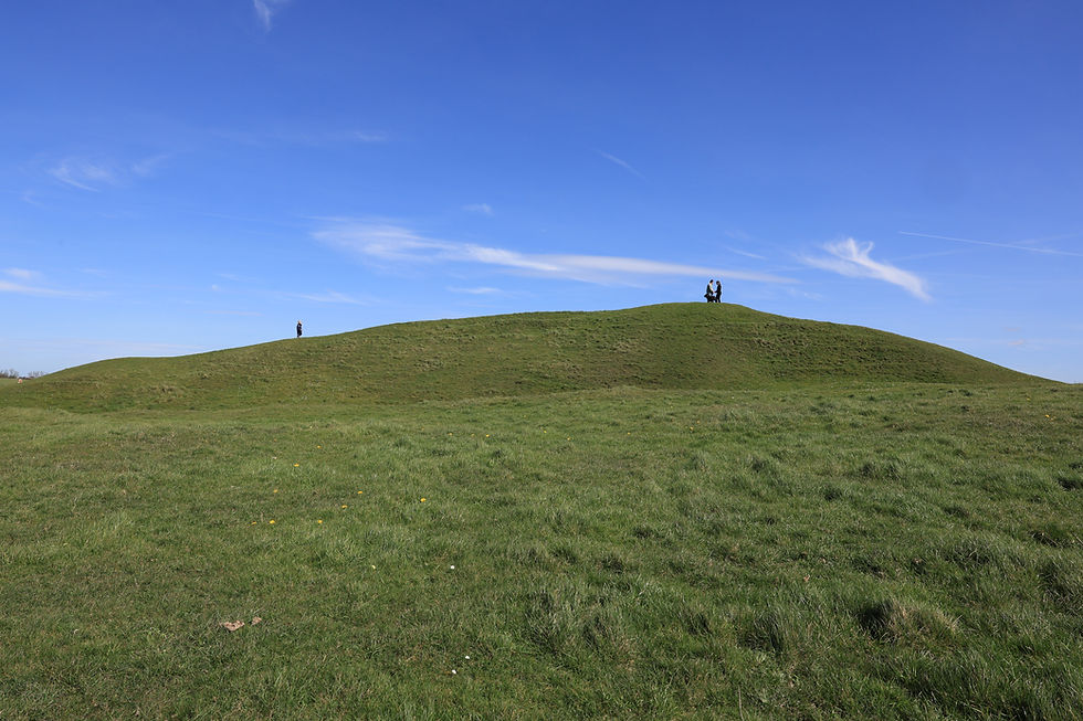
Anyway, back to my walk in May 2025, the Sarsen Way began a steep climb up Walker’s Hill. At the summit of Walker’s Hill and overlooking the Vale of Pewsey was a Neolithic long barrow known as Adam’s Grave. Whoever Adam was, he couldn’t have chosen a finer location. According to folklore the barrow is the grave of a giant, which explains the dimensions of it – 70 metres long and 7 metres high!



At this point I decided to briefly go off-piste and head higher and closer to Milk Hill, the highest point in Wiltshire. From there I got even better views of Adam’s Grave and the surrounding area; so many ‘Wow!’s. Milk Hill is 966 feet high. I didn’t walk all the way round to it but the OS map tells me I got to 944 feet.
The Alton Barnes White Horse is located on the southern slope of Milk Hill. He’s approximately 180 feet high and 160 feet long and was cut in 1812 under the commission of local farmer Robert Pile. He can be seen for miles around. At the time of my walk he was looking in mighty fine condition.


Having got all the photos and videos I wanted, I returned to the Sarsen Way which took me down Walker’s Hill to a road. On the other side of the road was Knap Hill and a car park. Knap Hill is another steep hill that has a neolithic causewayed camp (an enclosure marked out by ditches and banks, with a number of causeways crossing the ditches) at the top. As there was so much more I wanted to see today, I decided not to climb the hill, which in any case wasn’t on the Sarsen Way.

However, over Easter 2026, I returned to the area and climbed to the top of Knap Hill for more ‘Wow!’ moments. Unfortunately it was way too windy to get my little drone up in the sky to fully appreciate the earthworks here; a little frustrating, so I’ll just have to return another time soon and also continue along Golden Ball Hill.


Back to my May 2025 walk - continuing beyond Walkers Hill, the Sarsen Way initially climbed towards the Wansdyke (an early medieval defensive ditch and embankment – think of it as a kind of Hadrian’s Wall). From there, the path descended slowly towards East Kennett. The views were spectacular all the way along here. Before reaching East Kennett was East Kennet Long Barrow. There is no public access and it’s not located on the Sarsen Way anyway, so I gave this a miss. East Kennett is a small village just ½ mile from the A4 and Overton Hill. By the way, I’m confused by the spelling of Kennet/t! Road signs and OS maps spell it with 2 ‘t’s, whereas English Heritage & National Trust choose to use just 1 ‘t’. Who’s right – goodness only knows!


Just before the A4 is The Sanctuary, originally a complex arrangement of 6 circles of timber posts and standing stones begun in about 2500 BC. The Sanctuary is at one end of the West Kennet Avenue - 2 parallel rows of standing stones that stretch over 1½ miles linking the site to the henge and stone circles at Avebury. Nobody is 100% sure what the purpose of The Sanctuary was. When archaeologists excavated the site in 1930 they found many objects such as flint tools, animal bones and pottery fragments, suggesting that Neolithic people were placing offerings in and around the standing posts. Other excavations discovered the body of a teenage boy from the early Bronze Age, about 200 years after the Sanctuary was constructed; he’d been buried against the base of one of the stones. As the monument was destroyed in the 18th century by a local farmer digging up the stones and posts, today they have been replaced with concrete blocks painted blue on top for stones and red on top for wooden posts. Fortunately, detailed drawings of the monument existed from before it was destroyed!


After crossing the A4 at The Sanctuary I arrived at the official start of The Ridgeway National Trail at Overton Hill. Whilst the Sarsen Way ‘code shares’ with The Ridgeway as far as Barbury Castle near Swindon, for the purposes of my blogs I finished the Sarsen Way here and my next walk would be along The Ridgeway.


As mentioned at the start, there is so much more to see whilst you’re at Overton Hill – West Kennet Long Barrow, Silbury Hill, West Kennet Avenue and Avebury itself being the most spectacular. I also mentioned that you catch buses at the Red Lion pub in Avebury. The 49 bus travels between Swindon, Devizes and Trowbridge all day until late in the evening.

A – The Sanctuary
B – Overton Hill – start (or finish) of The Ridgeway National Trail
C – West Kennet Long Barrow - one of the largest, accessible Neolithic chambered tombs in Britain
D – Silbury Hill - the largest artificial mound in Europe
E – West Kennet Avenue - An avenue, originally of around 100 pairs of prehistoric standing stones
F – Avebury - the largest stone circle in Britain
G – Windmill Hill - one of the first sites excavated to provide evidence of the life of early farming communities in southern Britain
I won’t bore readers with any more history of the sites, so here’s a link to the English Heritage site which tells you everything you need to know about Avebury -
Here are some photos from the other Avebury sites. Windmill Hill is getting on for about a 2 mile walk from the centre of Avebury.


Comments