Stage 25 - Peddars Way - Knettishall Heath to Watton - September 2nd 2025
- John Tippetts

- Apr 14, 2025
- 6 min read
Updated: May 2
Official Stage Statistics
Route distance – 14.03 miles
Duration - 5 hours 13 mins
Total ascent – 392 feet
Total descent – 326 feet
Highest point – 166 feet

Logistics
Drive to Cambridge North station & park car CB4 1UN - £9.80
Catch 08:19 train to Thetford - 42 mins
Get taxi to Knettishall Heath Icknield Way Car Park - £20
Walk to Watton
Catch 82 bus to Attleborough from stop opposite Crown Hotel at 13:50 14:50 16:10 17:10
Walk to Attleborough Station - 10 mins
Catch train back to Cambridge North 14:46 & hourly
Drive home
My Walk
The Peddars Way is almost straight as an arrow. As close as possible, it follows an ancient Roman route along tracks, footpaths and minor roads towards The Wash. With the exception of Castle Acre, it’s not desperately interesting IMHO – pretty in places but that’s it. Looking at the Peddars Way and Norfolk Coast National Trail as a whole, I see the Peddars Way as very much the starter ahead of the main course which takes the walker along the Norfolk coast, taking in coastal wildlife reserves, birdlife and seaside towns. This National Trail is therefore very much a trail of 2 halves.
Today’s first stage would begin at Knettishall Heath where the Icknield Way Path finished and in less than ½ mile the path would cross a bridge over the River Little Ouse into Norfolk – the 11th county the Great Chalk Way passes across. Being a National Trail, the Peddars Way would be extremely well signposted and for another 6 miles, I’d walk along a well defined path, over the busy A11 and on to the village of Stonebridge. For much of the time the path would be tree lined, resulting in limited views.
In Stonebridge, the path would continue along a road for a mile or so before becoming a wide track. For much of the remainder of the walk, most of the land on the left hand side would be fenced off with countless ‘Military firing range. Keep out’ signs. This was Stanford Training Area – referred to as STANTA.
In 1942 the Ministry of Defence (MOD) compulsorily purchased 30,000 acres of land in the Brecks to turn into a battle training area. To do so it evacuated the villages of Buckenham Tofts, Langford, Stanford, Sturston, Tottington and West Tofts. At the time the villagers were told that they would be able to return to their homes after WW2; however, the MOD later reneged on its promise and this continues to cause resentment. The area became known as STANTA. One positive outcome of the evacuations was that it resulted in the creation of the largest SSSI in lowland Britain. Rare Breckland flowers and birds, such as the stone curlew, now thrive.
The training area originally had a mock German village constructed. Subsequently a replica of a typical Afghan village was built. In 2022, STANTA was used by the British Army and armies from a number of other allies to deliver basic and leadership training to the Armed Forces of Ukraine. Numerous outdoor locations within STANTA were used for the filming of Dad’s Army and even today, a few locations can be hired for filming locations. Once again, the things I learn as a result of my walks!
As this section alongside STANTA was through light woodland, there wouldn’t be a great deal to see on the right hand side either. Eventually I’d reach the northern end of STANTA and the Peddars Way would bear left. However, having decided to finish my walk at Watton, I’d continue straight on for about a mile to reach the market town of Watton.

My day began with a drive from home to Cambridge North Station. Cambridge North is easier to reach than the main station as you don’t have to drive into the city centre. I caught the train to Thetford and there was a waiting taxi outside the station. The driver was familiar with the Icknield Way car park at Knettishall Heath and by 09:15 I was ready to start the final trail of the Great Chalk Way.

The start of the walk was very much a continuation of the Icknield Way Path. I very soon crossed a small wooden bridge over the River Little Ouse and in so doing I crossed from Suffolk into Norfolk.


After crossing a couple of roads, the path entered a forested area described as Thorpe Forest. The forest is the home of Forest Holidays Thorpe Forest which specialises in log cabin hot tub breaks!

Beyond the log cabins the path continued along a long wooden boardwalk leading up to a wooden bridge over the River Thet. This area is subject to flooding at times; hence the boardwalk. In fact, a notice attached to a fingerpost showed a long diversion if even the boardwalk was under water. This diversion was waymarked. A couple of workmen were replacing a section of the boardwalk as I walked over it.


Once over the Thet, the next couple of miles were along paths through more woodland with breaks every now and again.


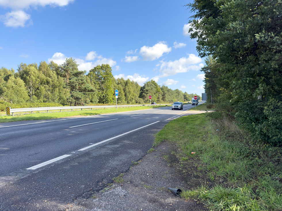
The path emerged onto the A11 – a busy dual carriageway. There was no bridge or subway but at least there was a central reservation, so it wasn’t too bad getting across.

Beyond the A11, the path crossed the Norwich mainline railway tracks at Shadwell Crossing. For those of a nervous disposition, military troops on foot and groups of pedestrians, an underpass was provided! Continuing beyond the railway, the next 2 miles were dead straight, initially through a wooded area but then along a more open path, before emerging into Stonebridge. Various areas on my left were fenced off with ‘Military Firing Zone – Keep Out’ signs.


After crossing the main road through the village, the path took a left along a metalled road through yet more woodland. After a mile of walking along the road it became more of a wide track and this is where the continuous STANTA fences and warning signs began. For the next few miles of walking through woodland, the left hand side was all out of bounds.


The right hand side was also tree covered – by no means unpleasant but not very exciting. I did however pass an unusual sculpture. This was the first of 5 sculptures along the trail. The sculptures are part of a multimedia art project called “A Norfolk Songline”. The project was inspired by the Peddars Way. I knew there were 5 sculptures to look out for but I didn’t know exactly where they were located - the excitement of the Peddars Way!.
This first sculpture had the text -
“The footprint of our ancestors
Familiar as our own faces
Remote as fossils
Written on clay
And washed away
Over & over
Over and over”

A little beyond the sculpture there should have been (and quite probably was) a turning to the right to take me to Thompson Water, a manmade lake and part of the Pingo Trail walk. Walkers often stop here for a break. For my part there was so much tree cover and foliage that I may have missed the turning. I wasn’t too upset.
After another 3 miles of mainly walking through woods I finally reached a fingerpost pointing left for the Peddars Way but straight on for 1 mile to Watton. Even though it was only 1:15, I’d decided to finish at Watton for the day, since it offered me the public transport I needed to get back to Cambridge.


The last mile began as a wide track which narrowed quite considerably before reaching the main road into the town. I subsequently discovered that I’d missed the second Songline sculpture shortly before I left the trail to walk into Watton!


Watton is the smallest of the Breckland’s 5 market towns. I have to commend the council on the state of the town’s public conveniences – absolutely spotless! I got to my bus stop with a couple of minutes to spare. The driver of the bus drove at breakneck speed to Attleborough, a very attractive market town. The railway station was a 10 minute walk from the town centre and my train to Cambridge arrived on time.
Sitting on the train, thinking about today’s walk, it had been very easy but with so much walking through woods, it hadn’t been very interesting to be honest. I’d completed it in under 4 hours which reflects the flat terrain and there being little for me to stop for.
Here’s hoping the next walk would be more satisfying!


Comments