Stage 24 - Icknield Way Path - Icklingham to Knettishall Heath - August 26th 2025
- John Tippetts

- Apr 15, 2025
- 9 min read
Updated: May 2
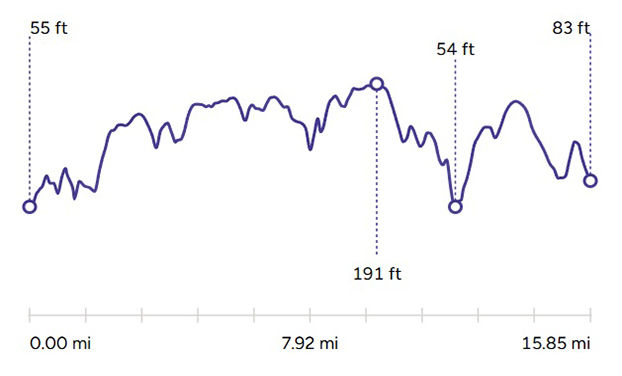
Official Stage Statistics
Route distance – 15.85 miles
Duration - 5 hours 58 mins
Total ascent – 567 feet
Total descent – 550 feet
Highest point – 191 feet
Logistics
Drive to Cambridge station & park car - Rustat Avenue, Cambridge - JustPark
Catch 08:00 Cross Country train to Ely
Catch 08:30 train to Bury St Edmunds
Catch 355 bus to Icklingham 09:20 - 20 mins OR if lucky catch 16 bus at 09:02!
Walk to Knettishall Heath - about 6 hours
Get taxi to Thetford Railway Station – Ask to be collected at Icknield Way car park - LJs 01842 552907 - £20
Catch train to Cambridge - 48 mins
Drive home
My Walk
The final leg of the Icknield Way Path, within the area known as the Brecks, would be mainly about trees – and lots of them, as the path would take me through the 5800 acre King’s Forest, part of the much larger Thetford Forest complex. Beyond the forest, the path would continue along footpaths and farm tracks towards Euston, the only settlement of this whole stage. After stopping in Euston to eat my sandwich, I’d then push on for the final 3½ miles to Knettishall Heath. The surface of the path would become more and more sandy as I progressed and this would be really noticeable in places where it would feel like I was walking along a sandy beach! Despite the sand, because this part of the country is so flat, this would be a very easy and enjoyable walk.
The Brecks is an area of 390 square miles either side of the Norfolk/Suffolk border. The name was coined after WG Clarke published ‘In Breckland Wilds’ in 1925. The land is characterised by forest, heath, farmland and dry sandy soil. Over the last hundred years the ancient character of the Brecks has been changed forever. The large-scale pine plantations of Thetford Forest and the use of modern farming technology have transformed much of it into more productive land. The remaining stretches, and the more open parts of the forest are now vital areas for wildlife conservation.
The logistics for this stage were going to be a little more convoluted today. I began with a drive from home to Cambridge and once again I found a private parking space close to the railway station using the JustPark app.
I caught the 08:00 train to Ely, changing there for the train to Bury St Edmunds. I then caught the number 16 bus back to Icklingham. The first 1½ miles of this stage involved walking alongside a number of fields before reaching a T-junction. A left turn would take me along a byway into King’s Forest, whereas a right turn would take me down to a road that would go past West Stow Anglo Saxon Village.
Interestingly, back in April when my sister and I were having a Sunday walk along The Ridgeway in Wendover, a fellow walker stopped and asked us for directions, as the HS2 works had resulted in the closure of a number of local roads. We got talking and I told him I was planning to shortly walk the Great Chalk Way from end to end. He mentioned that he’d recently had to call a halt to his walk along the Icknield Way Path at Icklingham because the official route through King’s Forest was closed. I thought this sounded a bit extreme as the forest is fairly large, so surely there must be another way through it! Anyway, we pointed him in the right direction through Wendover and I thought no more about it until I started planning this final stage.
So, in August I started googling and discovered that, sure enough, the official route through the forest was along one of the byways that Suffolk County Council had slapped a Traffic Regulation Order on in August 2024, valid until February 2027. I did actually write to the council asking if there was a diversionary route but was told there wasn’t one. I was told the closure of the byways was due to widespread damage caused by 4x4 vehicles and trail bikes. The byways would be closed until repairs had been carried out. It struck me that surely they meant the closures only related to vehicles, not pedestrians.


I also found this reply to a Freedom Of Information request online -
2/ The documented "risk to public safety" that would be expected to arise from the use of these byways by (a) Pedestrians, (b) cyclists, and (c) horse-riders, outside of times when any resurfacing works are in progress. Was any consideration given to whether the objectives could have been achieved by closing the routes just to motorized vehicles, and only implementing a full closure for the duration of any works?
Byways exhibited pervasive features which were deemed a risk to public safety including all users. Consideration was given to whether closing routes to particular user groups would be possible, but due to the damage caused this was deemed not possible.
I decided in advance that I wouldn't mess about going up one of these byways only to be turned back if works were being carried out. I'm pretty certain I was overthinking things however!
Bearing all the above in mind, when it came to the day of my walk, having reached the T-junction where a left hand turn would take me into the forest along one of the closed byways, I was a good boy and instead turned right heading towards West Stow Country Park & Anglo Saxon Village. I would then walk along the road and turn left into the forest a little way to the east of the closed byway.

I passed the entrance to the country park. The Anglo Saxon Village is a recreation of a village occupied from AD 420-650. Just past the entrance I took a left into the forest. I knew that basically I had to walk roughly south to north for about 4 miles. The OS App on my phone ensured I didn’t veer off course. I just couldn’t believe that the chap we’d met in Wendover back in April had been put off by the closure of the official route.


King’s Forest was created by the Forestry Commission in the mid-1930’s. The planting of the forest coincided with the Silver Jubilee of King George V and Queen Mary in 1935 and the forest was given its name in honour of that occasion. Most of the forest is planted with pine which is sustainably managed for timber through a cycle of clearfelling and replanting, providing habitat for a number of ground nesting birds such as woodlarks and nightjars. There is also a network of broadleaf trees, mainly oak, across the forest and around the boundary.
Whilst there are no published figures for the number of trees in the forest, it's fair to say that there are an awful lot! It was a very pleasant and calming experience walking through it. I only passed a couple of dog walkers and that was it. As I wasn’t following the official path, I was so grateful that I had the OS App, as with so many small paths it would have been so easy to go off course and get lost – something it didn’t bear thinking about.


After about 75 minutes I reached Queen Mary’s Avenue, a path planted with beech trees rather than pine trees. I was now back on the Icknield Way Path, even though the route was officially closed. At the end of the avenue I emerged into the open and was greeted by a commemorative stone. This stone had the wording "This stone commemorates the Silver Jubilee of King George V. The Forestry Commissioners began in 1935 to afforest the King's Forest and to plant with beeches Queen Mary's Avenue which follows the course of the Icknield Way."


I was also greeted by another notice advising me of the closure of byways, including another one that the official path was meant to follow. Looking at the council’s map and construction work that I could see was going on, I chose to cut out trying to get to Barrows Corner; instead, I took the route that I’ve highlighted in yellow on the next OS Map extract. This route involved walking along the north-eastern edge of King’s Forest until I rejoined the official path, which again was officially closed!


Even though the landscape was flat as a pancake I was really enjoying my day walking amongst so many trees and admiring the views from gaps between them. The Icknield Way did a hard 90° left turn along a track and after another ½ mile, it took a hard 90° right turn along a stony-surfaced track, passing a large pig farm.


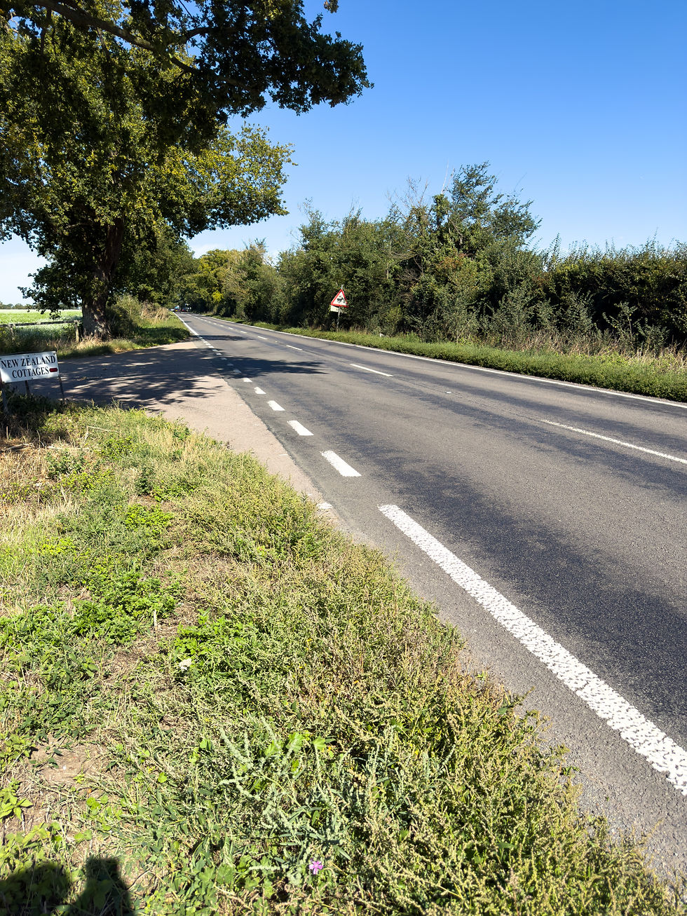
I eventually reached and crossed over the A134 road. On the other side the path would continue virtually straight for about 3¾ miles, along a variety of surfaces, including sand which conspired to slow me down. I was very close to RAF Honington, home to RAF Force Protection. The station is a central hub for training RAF Regiment Gunners and RAF Police, featuring 25-metre ranges for live-fire training. There was a lot of training taking place on the day of my walk but thankfully no stray bullets came my way!


The path emerged onto a road in the village of Euston. There was a lovely piece of green space with a bench, so I stopped here for my sandwich and a short rest. I was now just over 3 miles from Knettishall Heath!


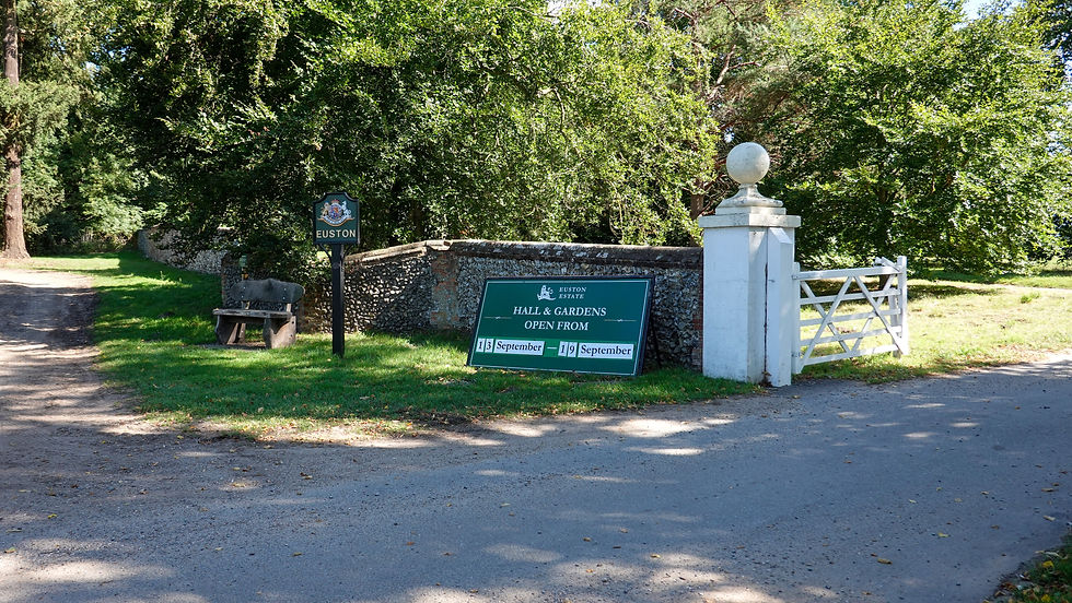

Continuing for the final push, the path entered Euston Park, part of the 10,500 acre Euston Estate which is home to the 12th Duke of Grafton. The walk through the estate was pleasant enough with a mixture of open fields and lightly wooded tracks. After crossing one final minor road, the path continued towards the 3rd Icknield Way Association stone plinth milestone, which you’d have assumed would mark the end of the Icknield Way Path. If you didn’t know where to find it, you’d probably never know it was there because of the undergrowth around it. The easiest way to find it is to use the What3Words app. It’s location is at outraged.position.sharpened Having found the milestone, I cleared some of the undergrowth to get a couple of photos of it.
Incidentally, I can’t recommend What3Words highly enough for solo walkers in particular. In the event of ever getting into trouble (heaven forbid) and having to call the Emergency Services, being able to quote your exact location to the nearest 3 square metres from What3Words could potentially be a lifesaver. The app relies on GPS rather than a mobile phone signal. I have the app on the home screen of my phone for easy access.


Interestingly, the Icknield Way Path continued for almost another ½ mile before reaching the official end of the trail in a car park at Knettishall Heath. One of the new Great Chalk Way information boards had been installed right next to a fingerpost telling me that Ivinghoe Beacon was 105 miles in one direction along the Icknield Way and Holme-next-the-Sea was 46 miles in the other direction along the Peddars Way. For me, this was the best handing over of the baton from one trail to the next along the Great Chalk Way! I’d now completed the longest of the 6 trails that comprise the Great Chalk Way.


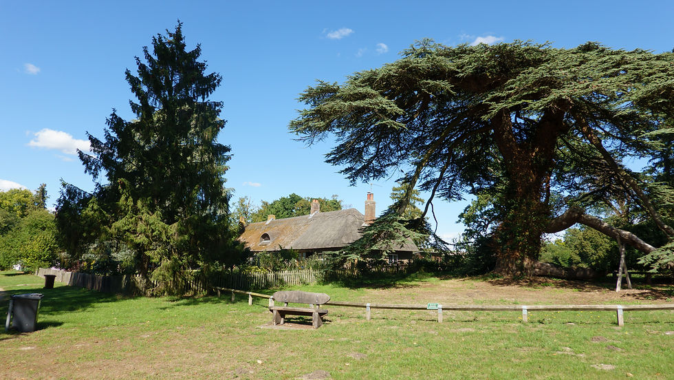
Knettishall Heath is a nature reserve extending to more than 430 acres. It retains a sense of what the whole of the Brecks would have looked like before the likes of Thetford Forest and King’s Forest were planted and modern farming techniques were implemented. Wild ponies graze on the heath all year round. The heath is extremely popular with walkers and cyclists.


As everybody knows, facilities at Knettishall Heath are very limited. There are toilets in the main car park along Knettishall Road – 9:00 am – 4:30 pm. There is also a mobile barista a couple of days a week and that’s it!
The Icknield Way Association has an alternative 5½ mile walk from Barrows Corner on the edge of King’s Forest, finishing in Thetford. They refer to it as the Thetford Link. Thetford is a market town with shops, pubs, a railway station, taxis and even one of my beloved Premier Inns! If you’re not continuing along the Peddars Way then the Thetford Link might well be for you; however, for me this would have been so unsatisfactory as I wanted to reach the official end of the Icknield Way Path.

As a solo walker, a taxi from Knettishall Heath to Thetford Station was the answer. There are a number of car parks at Knettishall Heath, so when I phoned for a taxi it was important to say I wanted to be picked up from the Icknield Way Car Park – What3Words . I used LJs Taxis in Thetford. A friendly driver picked me up and drove me to the station. The fare was £20 – quite reasonable for the distance.
Back in Thetford I caught a direct train to Cambridge where my car was and I then drove home.
Icknield Way Path complete; now just the Peddars Way to go to finish my coast to coast walk!


Comments