Stage 19 - Icknield Way Path - Toddington (Harlington) to Ickleford - August 9th 2025
- John Tippetts

- Apr 20, 2025
- 6 min read
Updated: Jun 1
Official Stage Statistics
Route distance – 15.20 miles
Duration - 6 hours 1 mins
Total ascent – 1083 feet
Total descent – 1175 feet
Highest point – 609 feet

Logistics
Drive from Premier Inn Hitchin to Harlington Station car park LU5 6LD - £3.50 at weekends
Walk down Sundon Road for 1.2 miles to pick up Icknield Way Path
Walk to Ickleford
Catch bus 9A from Church to Hitchin
OR
Walk to Bedford Road & catch 9B 74 or 89 bus to Hitchin
Walk to Hitchin railway station and catch train to Harlington
Pick up car and drive home
My Walk
The 2nd stage of the Icknield Way Path would begin with a tiny bit of cheating. I wasn’t going to allow my irrational fear of crossing any of the M1 bridges at Toddington to spoil my walk. I’d done a lot of research before starting the Icknield Way Path and using Google Maps, had evaluated and rejected all the M1 crossing points in the vicinity. So, instead I would start today’s stage on the other side of the motorway at Harlington Station and walk from there down Sundon Road to join the Icknield Way at the point the alternative route from Toddington met it.
With that out of the way, today’s walk would start with a climb to the top of Sundon Hills Country Park, a beautiful chalk grassland ridge with extensive views. The Sharpenhoe group of hills comprise Sundon Hills, Moleskin and Markham Hills, Sharpenhoe Clappers and Smithcombe Hills. The Icknield Way would follow this ridge before dropping into the village of Streatley.
After running parallel to the busy A6 and eventually crossing it, the path would climb again up Galley Hill with its views over Luton and then climb to the top of Telegraph Hill, the highest point of this stage and part of the Pegsdon Hills landscape with its magnificent views.
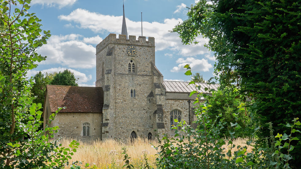
Beyond Pegsdon the path would descend slowly alongside fields to the pretty village of Pirton and then on to the end of the walk at Ickleford. The shape of the Bedfordshire Hertfordshire boundary means that I’d be popping in and back out of Hertfordshire during the day before finishing in Hertfordshire; that’s 3 counties so far that the Icknield Way would have passed through.

My day began at the Hitchin Premier Inn with a full English. I helped myself to a banana and a couple of pain au chocolat to see me through the day. I then drove to Harlington railway station and parked my car. I set off down Sundon Road and in less than a mile I picked up the Icknield Way Path. Like just about every stage of the Great Chalk Way, today was going to be a sunny and warm day.

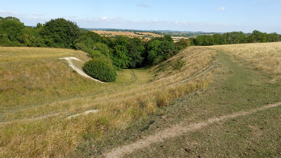
Immediately, the path started to climb to the top of Sundon Hills Country Park via a small disused pit. From the top were views across the ridge towards Sharpenhoe Clappers, site of a promontory fort ( a particular kind of Iron Age hillfort ) situated in a commanding position in the area that provided the best defence. These days it is covered in tall beech trees.


The Icknield Way followed the ridge towards Sharpenhoe but after entering the Sharpenhoe Clappers car park, rather than taking you to the fort, instead it cut across the hill towards the next hill, Smithcombe Hill. The geology of the land meant that I was doubling back on myself due to some steep escarpments below.


After Smithcombe, the path descended towards the A6 but rather than crossing it here as I would have expected, instead it entered the attractive village of Streatley. I stopped at a bench by the side of a tree-covered pond in the village and ate my banana and the pains au chocolat I’d taken from the Premier Inn at breakfast time.


Moving on, for the next mile or so I walked alongside a number of fields that were themselves roughly parallel to the A6. Eventually I emerged onto the A6 and crossed it, literally on the northern edge of residential Luton.


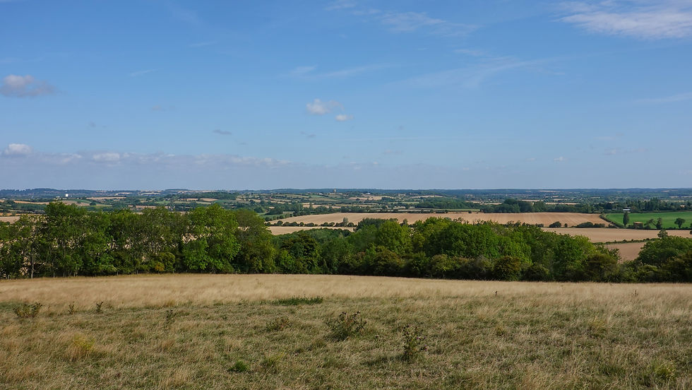
The path took me onto South Beds Golf Club with Warden Hill right in front of me and Galley Hill to the left. The path took me up Galley Hill which forms part of the Galley & Warden Hills Nature Reserve. The top of Galley Hill provided panoramic views of the town of Luton and the more attractive countryside to the north of it.


After crossing one more fairway, the path carried on in an almost dead straight line along what some people label ‘proper Icknield Way’ i.e. the original ancient trading path rather than the collection of modern day footpaths comprising the Icknield Way. I like to imagine the cobbled bricks I walked over had a reasonable amount of age to them, if not thousands then maybe hundreds or tens at least!!


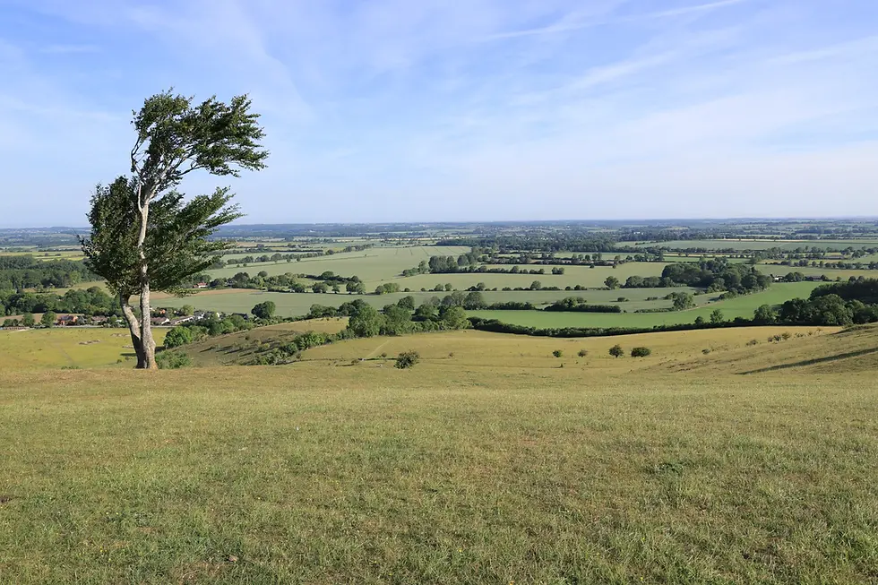
As is often the way, the path was sandwiched between dense vegetation comprising hedges and trees, with openings here and there. In summer, the vegetation cover is at its greatest. This is the excuse I’m using for walking straight past the Pegsdon Hills and Hoo Bit Nature Reserve! The Pegsdon Hills are known for some of the best panoramic views in Bedfordshire and I missed them. To remedy this, I returned in May 2026 to see what I had missed - and boy, I'd missed a lot. In particular, Deacon Hill, apart from being an SSSI has ancient earthworks as well as a trigpoint pillar.
I would strongly recommend that walkers should follow the path through the nature reserve and over the top of Deacon Hill, rather than the official Icknield Way Path. Whichever way you go however, you end up a small car park by the side of the B655 - Hexton Road Car Park.


Back to August 2025, having unknowingly walked past the Pegsdon Hills, the path continued with hedges and trees on both sides and a bit of road walking – pleasant but not inspiring. I passed another nature reserve, Knocking Hoe National Nature Reserve. The views were fabulous.


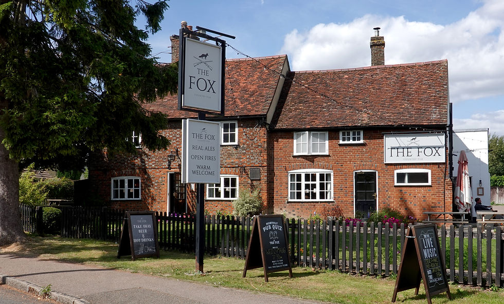
I was getting closer to the village of Pirton which was a good thing as I’d run out of water. Pirton has the remains of the earthworks of a medieval motte and bailey castle that was called Toot Hill but I missed them. I didn’t realise this at the time but I probably walked past the earthworks without realising what they were! On the other hand, I did pass a pub called The Motte & Bailey in the village!


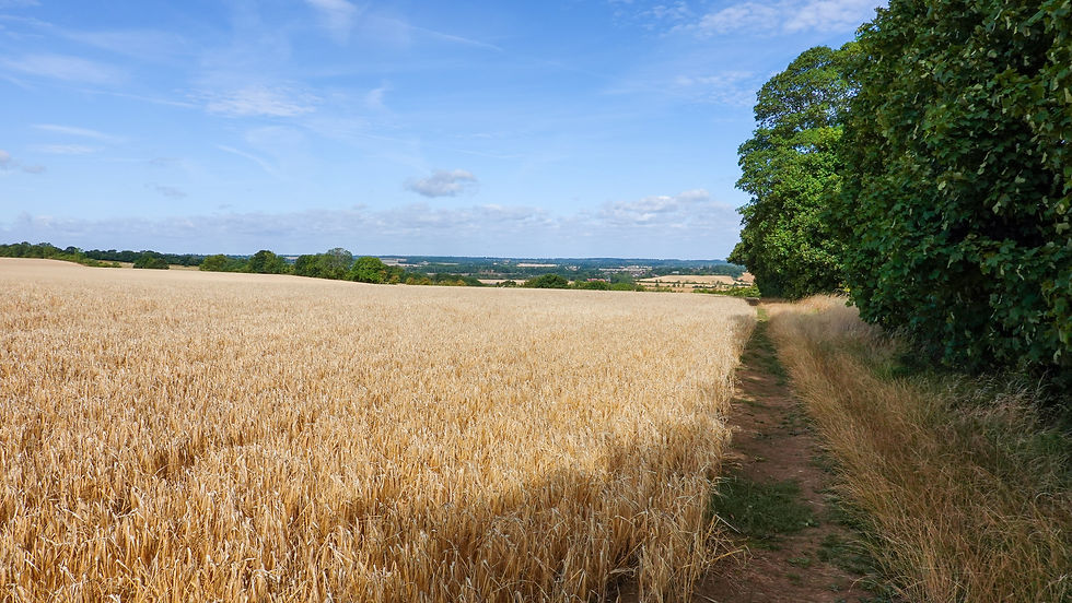
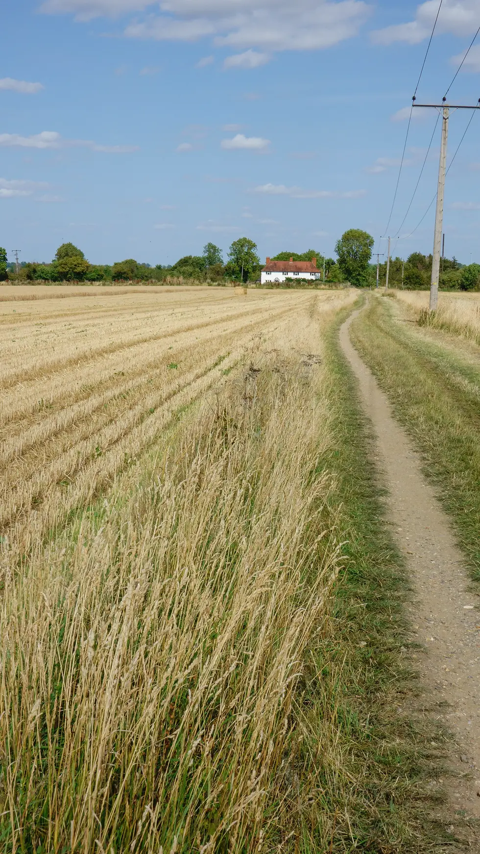
I settled on stopping at the other pub in the village, The Fox, for a soft drink, a packet of crisps and a top up of one of my water bottles. Duly refreshed I set off for the last couple of miles alongside the hedges of fields that had either recently or were being harvested. Again, pleasant but not too inspiring. Having said that, there is something to be said about photos taken on a sunny day of landscapes featuring harvested fields and natural hedge borders. The colours go very well together and the photos make for better photos than those of fields with green crops!


The path eventually reached the busy main road between Hitchin and Henlow Camp. I crossed the road and continued for a few hundred yards into the village of Ickleford. This is where this stage finished.

I could have walked into Hitchin from here to get back to my car in Harlington but I was rather hot and sweaty. Instead, I walked back to the main road and a bus turned up almost straight away. Back in Hitchin I walked to the railway station and caught a Thameslink train to Harlington where my car was. I then drove home.


Today’s walk was enjoyable but not as interesting as I’d been used to; the landscapes were outstanding however and made up for this. I’d been really spoilt up to now in terms of history and hill climbing. I accepted that much of the Icknield Way from here on would be all about the landscapes.
Tomorrow's walk was going to be longer than today's and take in 3 towns - Letchworth Garden City, Baldock and Royston.


Comments