Stage 20 - Icknield Way Path - Ickleford to Royston - August 10th 2025
- John Tippetts

- Apr 19, 2025
- 8 min read
Updated: May 2
Official Stage Statistics
Route distance – 17.67 miles
Duration - 6 hours 55 mins
Total ascent – 1108 feet
Total descent – 1065 feet
Highest point – 549 feet

Logistics
Drive to Hitchin & park at Woodside Long Stay Car Park SG4 9SG
Walk to Ickleford or catch bus 9B, 9D or 89 to Burford Grange stop & walk to Ickleford
Walk to Royston
Catch train from Royston to Hitchin
Walk to Woodside Car Park & drive home
My Walk
The 3rd stage of the Icknield Way Path would begin with a short walk to Letchworth Garden City and from there on to Baldock. Beyond Baldock the path would rapidly become rural in nature with a mixture of walking alongside arable fields or alongside the familiar corridors of tall hedging either side of fields. The path would pass the villages of Clothall and Wallington where it would merge with the Hertfordshire Way as far as Sandon. From beyond Sandon the Hertfordshire Way would go its own way whilst the Icknield Way Path would head for Therfield and the highest point on today’s walk.
The final 2½ miles to Royston would continue in much the same vein as the rest of this stage but just towards the end it would emerge onto Therfield Heath Nature Reserve, a 350 acre SSSI featuring Neolithic, Iron Age and Bronze Age archaeological artifacts. At more than 17½ miles this would be my longest walk along the Icknield Way Path.
My day began with an early morning drive from home to the Woodside car park in Hitchin. Today was going to be another hot, sunny day. I caught the bus back to the nearest stop to Ickleford and walked into the village.


Ickleford is one of those places where there are different Icknield Way routes depending on your mode of propulsion and you have to be careful which signs to follow. In this case, the Icknield Way Equestrian Trail took a different route to walkers and cyclists, resulting in the crossing of railway lines over different bridges. I carefully followed the signs and on a tree-lined path crossed a small wooden bridge over the River Hiz. Almost immediately was a bridge taking me across the East Coast main line and Thameslink local line railway tracks.


Once across the railway tracks the path carried on for a mile or so alongside fields.


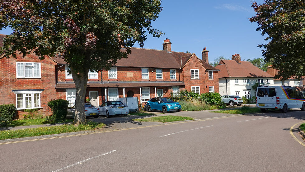
The path emerged onto Stotfold Road which it crossed onto Wilbury Hill, before reaching the residential streets of Letchworth Garden City
Despite its name, it is only a town with a population of about 34,000 people. Letchworth is famous for being the world’s first Garden City. Based on the ideas of Ebenezer Howard, construction began in 1903 under the ownership and control of First Garden City Ltd. Garden Cities were seen as a solution to the squalor and poverty of urban life in Britain in the late 19th Century. One consequence of this was that all houses should be built on relatively large plots resulting in bigger than average gardens. The tree-lined streets I was walking along reinforced this ethos.


There were also to be plenty of green spaces around the town. An aerial photo of the town shows how compact the town is and how much green space there is.


Central to the company’s ethos was a commitment to repatriate all profits back into the estate. Today the estate is managed by Letchworth Garden City Heritage Foundation. Any proposed changes to properties have to be approved by the foundation and changes need to stick to the published guidelines.
One other thing that Letchworth is famous for is the UK’s first roundabout, built in around 1909. Unaware of this fact before my walk and not on the route of the Icknield Way Path itself, I went back in November 2025 to visit Sollershott Circus for myself. It was originally built as a pedestrian refuge at the intersection of 3 roads. Twenty years later, a decision was taken to direct all traffic to move in the same direction and a roundabout, as we know it today, was created!


As I reached the town centre I couldn’t help but notice what looked like a pair of identical art deco buildings each emblazoned with the name The Spirella Company of Great Britain Ltd In fact, together with a building at the rear connecting them, they were formerly a factory manufacturing corsets from 1912 until 1989! The owners fully embraced Ebenezer Howard's vision of healthier living for workers. Referred to as the "factory of beauty", it offered a wide array of employee amenities including "baths, showers, gymnastics classes, a library, free eye tests and bicycle repairs". The building was Grade II listed in 1979 and acquired by the town in 1994. Following an £11 million regeneration project by Letchworth Garden City Heritage Foundation, the building is now leased out as office space.

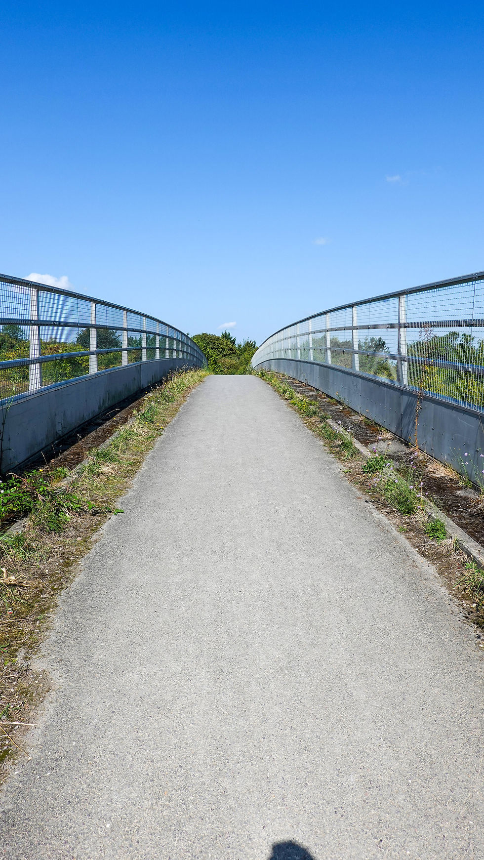
Anyway, history lesson over at last. After walking past the Spirella Building, the path took me along more tree-lined residential roads with traditionally designed houses and each house had a bit of green front garden. The streets and houses were just as I imagined. Industry was confined to an area on the north east of the town and the path took me through this area before veering off to the right down a narrow pedestrian footpath. I then crossed a footbridge over the A1(M). I’d looked at this bridge on Google Maps at the planning stage for this walk and decided that as it was relatively wide and not too high or long, I’d be able to cross it without getting totally stressed out. Whilst not desperately pleasant for me it was OK.


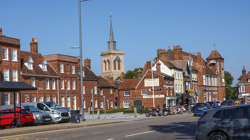
The bridge brought me into Baldock, a small, historic market town of about 11,000 people. Despite its size, it has a railway station. The Icknield Way took me down the High Street where there were a number of cafés with people sitting outside enjoying the Sunday sunshine.

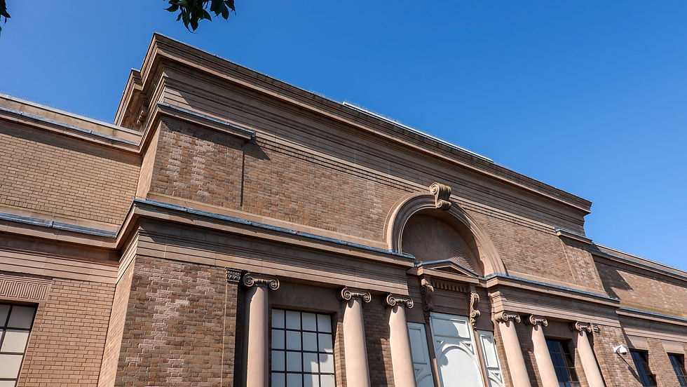
Set slightly back from the road was an impressive, large building and I was keen to see what it was. I got quite a surprise when I saw the large ‘Tesco Extra’ sign attached to the façade! It turns out that in 1924, inspired by Howard Carter’s explorations of Egypt, a giant art deco factory was designed by architects PHS Burditt and built in Baldock to house a film processing company called Kosmos. Only four years later in 1928, the building was taken over by the Full Fashion Hosiery Company. As with Spirella in Letchworth, the company's management fully embraced the ethos of looking after its workers, providing them with a swimming pool, bowling green and tennis courts which were located in what is now the Tesco car park!
During World War II, the building was requisitioned for parachute manufacturing, just as the Spirella factory in Letchworth was. After the war the company went from strength to strength until finally closing in 1983. Tesco took the building over, retaining the art deco frontage, although I assume this was a requirement of planning consent. I did go inside to buy a sandwich for my lunch but sadly there were no signs of the building’s history.

This is turning into quite a history lesson and I’m only 5 miles into the walk!
The trail continued down Baldock High Street to a roundabout. Crossing the roundabout, it carried on along a residential street before narrowing to a tree lined footpath that led to a narrow footbridge over the busy A505 dual carriageway. Eek! I hadn’t noticed this bridge when I surveyed the route on Google Maps, which was possibly a good thing as I didn’t have any time to get pre-match nerves about crossing it. I have to say that unpleasant as it was, I looked straight ahead and crossed it.

With the A505 out of the way, the landscape quickly changed from urban to rural with the now familiar sight of large, recently harvested fields bounded by hedgerows. The path climbed slowly but steadily towards the village of Clothall and the top of Bird Hill provided some nice views across to Baldock. The top of the hill was also covered in an impressive mass of purple coloured flowers. Google Lens told me that these were Phacelia Tanacetifolia and who was I to disagree!


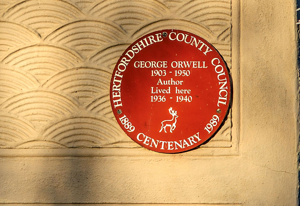
Continuing to climb, the path headed towards the village of Wallington. The author George Orwell lived at 2 Kits Lane Wallington between 1936 and 1940. His most famous book Animal Farm was written between November 1943 and February 1944 and published in 1945. The village of Willingdon in his book is widely believed to be based on Wallington.


In real life, the farm that served as the primary inspiration for the book was Manor Farm in Wallington. There was a rival claim made on behalf of Bury Farm in the same village and some believe the fictional farm was an amalgam of both.


The Hertfordshire Way joined forces with the Icknield Way just before and beyond Wallington. After a couple of miles, I entered the village of Sandon where I stopped to eat my sandwich at All Saints Church. The 14th century church is memorable for its, let’s face it, pretty ugly 17th century buttresses that presumably were built to support the tower! The brick courses of these buttresses aren’t horizontal but instead slope inwards, confirming they were built to add strength.


After passing through the churchyard the next 3 miles of walking continued through the churchyard with mostly all too familiar paths sandwiched between fields, shielded by a parasol of trees. This was pleasant enough on a warm afternoon but not very inspiring.


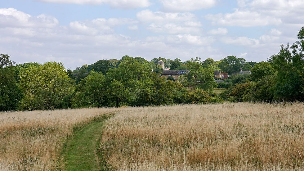
Eventually, I emerged into the really pretty village of Therfield, the highest point of today’s stage. Therfield is located on the northern edge of the Chilterns, specifically on a chalk ridge that forms part of this range, with its famous Therfield Heath known for being on the "final slopes of the Chilterns" and offering classic Chiltern landscape views. I’d read about Therfield’s village green pub, the Fox and Duck and this was proving very popular today. With less than 3 miles to reach Royston I was drawn towards the pub and decided to stop for a quick pint.


Beyond Therfield the tree lined paths finally opened up to give almost unbroken views of the landscape. It was downhill almost all the way now.


Just before reaching Royston, I emerged onto Therfield Heath, although it’s so close to Royston town centre that it’s also called Royston Heath. The heath contains a long barrow, thought to be Neolithic and several Bronze Age round barrows. I decided I’d have to come back to the heath to explore it more fully as it was so big. On a freezing, windy day in early January 2026 I came back with my drone.


The path descended into Royston town centre, marking the end of today’s walk. The railway station was a short walk away. From there I caught a Thameslink train back to Hitchin, walked to my car and drove home. A long but interesting and enjoyable day!
I allowed myself 4 days back home before embarking on the next stage from Royston to Great Chesterford.


Comments