Stage 21 - Icknield Way Path - Royston to Great Chesterford - August 15th 2025
- John Tippetts

- Apr 18, 2025
- 6 min read
Updated: May 2
Official Stage Statistics
Route distance – 14.07 miles
Duration - 5 hours 25 mins
Total ascent – 719 feet
Total descent – 798 feet
Highest point – 444 feet

Logistics
Drive to Rustat Avenue Cambridge & park car - JustPark
Walk to Cambridge Station
Catch train to Royston Station
Walk to Great Chesterford via Littlebury avoiding the M11 footbridge
Catch train to Cambridge
Walk to Rustat Avenue Cambridge & pick up car
Drive home
My Walk
On stage 4 of my Icknield Way Path walk, my irrational fear of narrow, high footbridges (gephyrophobia) would result in my longest detour to avoid having to cross the pedestrian bridge across the M11 and its slip roads at Junction 9.
Due to the shape of the county boundaries, in the space of just a few miles today’s walk would pass through Hertfordshire, Cambridgeshire and Essex. I chose Great Chesterford as my finishing point because it has a railway station with direct trains to Cambridge.
After leaving Royston, today’s stage would be very much a case of walking alongside large arable fields for much of the route, interspersed with passing through a number of quaint Essex villages like Crishall, Elmdon and Strethall. The official route beyond Strethall would take me over the dreaded footbridge, crossing 7 lanes of M11 motorway traffic and into Great Chesterford. For me this was never going to happen, so whilst crossing the M11 couldn’t be avoided, I decided I would use a less intimidating road bridge near Strethall. This bridge would bring me into the village of Littlebury and from there I would walk roughly parallel to the M11 into Great Chesterford. My diversion would cost me almost 2 miles of additional walking but the peace of mind it would give me would be priceless!!

As I was making my way eastwards along the Icknield Way, the landscape would become less and less hilly as I said goodbye to the Chilterns and this would be quite noticeable today with just one climb of any note into the village of Heydon.
To get to the start of today’s walk at Royston, my day began with a drive to Cambridge railway station. Rather than fork out £15.80 for the pleasure of parking in the NCP car park at the station, I’d pre-booked a parking space belonging to a property in Rustat Avenue using the Just Park app. I paid less than half of what NCP wanted. As this was the first time I’d ever considered parking at an individual’s property I was slightly wary. Would there be another car in ‘my’ space when I got there? I needn’t have worried because everything worked out fine. My space was empty and was less than 10 minutes walk from the station. Great start to the day. I stopped off at the Sainsbury's Local to buy a sandwich for my lunch. My reason for choosing Cambridge station was that I could get a Thameslink train to the start at Royston and at the end of the walk I could catch a Greater Anglia train from Great Chesterford back to Cambridge.
By just after 8:30 I emerged from Royston Station and walked down into the town to start my walk. It was yet another gorgeous day with not a cloud in the sky.


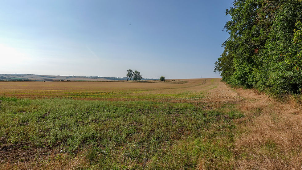
Within less than a mile I was out of the town and in the countryside. The OS map told me that I was walking along the ancient Icknield Way at this point. The landscape was relatively flat and dedicated to arable farming. The path mainly followed the edges of large fields although at times it was sandwiched between hedgerows – all very familiar stuff but still most enjoyable.


Having crossed the county boundary into Cambridgeshire, the path took a 90° turn to the right and began a gentle at first climb towards Heydon along the line of Bran Ditch (AKA Heydon Ditch). Most of the ditch has been lost to agriculture over the years.


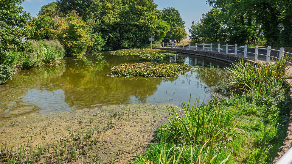
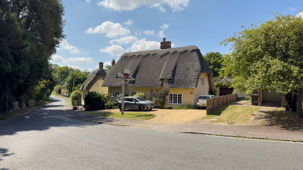
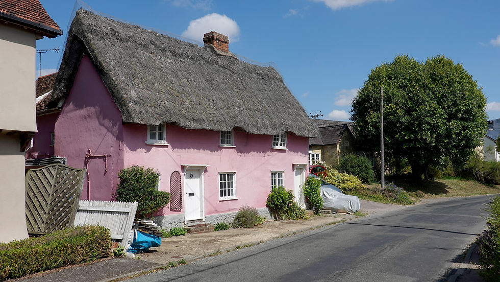
At 444 feet, the village of Heydon was the highest point of this stage; in fact, it’s one of the highest places in Cambridgeshire. Heydon has many attributes of a quintessential English village – village green ✔ church ✔ village pond ✔ pub ✔ thatched cottages ✔


Holy Trinity Church in the centre of the village was bombed by the Germans in 1940 and sustained a lot of damage. The north side of the nave and the tower were destroyed. In the 1950s, the church was restored. You can see from my photo that the tower was rebuilt using bricks rather than the original stone.

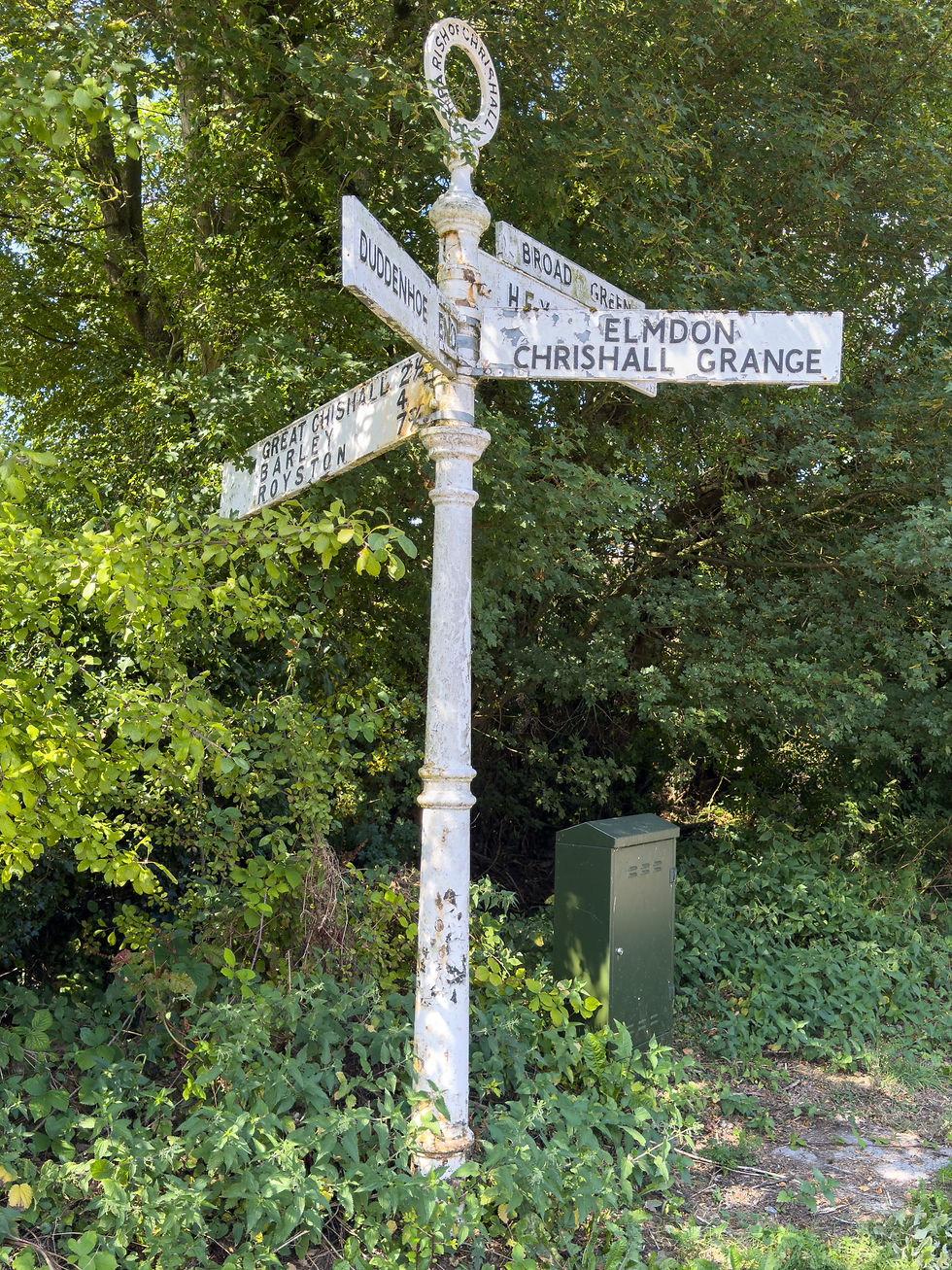
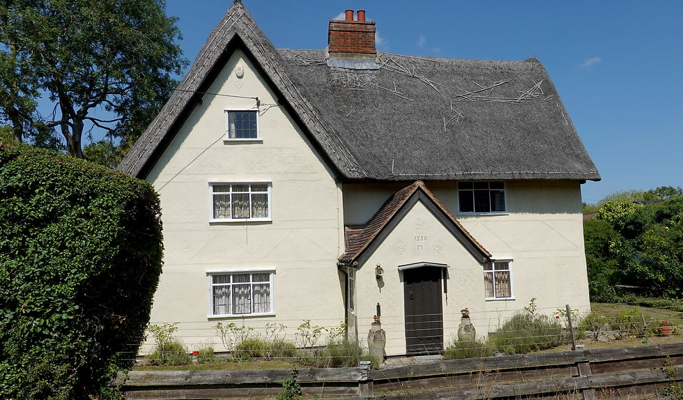
Beyond Heydon, the Icknield Way Path crossed into Essex – the 5th of the 7 counties the trail passes through. Over the next 3 miles the path passed through 3 more quaint villages – Crishall, Elmdon and Strethall.


In Strethall, the official path took a left towards the dreaded, narrow footbridge over the M11, although there was no waymarker on the fingerpost. In any case, I’d already planned my route to carry straight on instead and follow the road to a wider and much shorter bridge over the motorway.


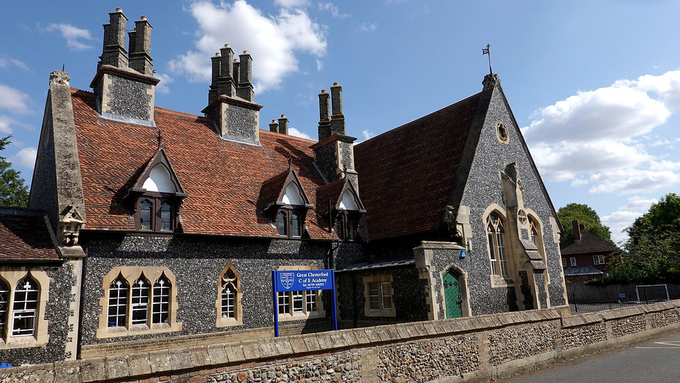
After crossing the motorway, the road dropped down into the pretty village of Littlebury. For the next 2 miles I walked along the verge of the quite busy B1383 towards Great Chesterford. It wasn’t ideal but I’ve walked on much worse & dangerous verges than this one. Eventually I reached the outskirts of Great Chesterford and a proper pavement. By now it was about 14:15. I was hot & sweaty and in need of a ‘proper’ drink, especially as I’d drunk all my water. With trains back to Cambridge every 30 minutes I was in no real hurry to walk to the station.


Naively, I assumed that as Great Chesterford had a railway station, it would undoubtedly have a number of shops and pubs. I did find the Crown & Thistle pub but it was closed for the afternoon. I could have walked a further 400 yards to the Plough but I really couldn’t be bothered as I’d have to walk all the way back again. As I couldn’t see any shops, I asked a lady if the village had any. She kindly directed me towards Days Bakery and Food Hall – the only shop in the village. There I bought an overpriced bottle of water.


I made my way to the station and waited in the sunshine for my train back to Cambridge.

Back at Cambridge Station I walked over the Tony Carter Bridge back to my car. The Tony Carter Bridge, named after a former councillor who championed the construction of this iconic bridge, was the longest covered cycle bridge in the world at the time it was completed in 1991. At 780 feet, it is still the longest covered cycle bridge in the UK. It crosses 16 railway tracks at a height of 21 feet and was built to improve road accident statistics involving cyclists. I can quite happily walk over this bridge without any qualms which doesn’t make too much sense. I suspect it’s because a) the bridge is covered b) it’s wider than the narrow footbridges that freak me out!
Anyway, back at my car, it was undamaged, not clamped and didn't have any rude messages stuck on the windscreen. I therefore deemed my first Just Park experience a big success and would repeat it for the next stage.


According to the OS map, I had now completed 60 miles of the Icknield Way Path, so had just another 50 miles to go. My next stage would take me back into Cambridgeshire, finishing in the village of Stetchworth. The good news is that I wouldn’t have to take any more detours to avoid pesky narrow footbridges!


Comments