Stage 23 - Icknield Way Path - Stetchworth to Icklingham - August 25th 2025
- John Tippetts

- Apr 16, 2025
- 7 min read
Updated: Jul 16
Official Stage Statistics
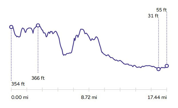
Route distance – 17.44 miles
Duration - 6 hours 31 mins
Total ascent – 538 feet
Total descent – 849 feet
Highest point – 366 feet
Logistics
Drive to Newmarket & park in The Guineas car park - CB8 8EQ £3 all day
Catch 903 bus to Stetchworth at 08:45 (but only on Thursdays!)
OR
Get a taxi - NewTax - 01638 561561 - £13
Walk to Icklingham
Catch 16 bus from Icklingham adj Red Lion (actually The Guinness Arms!) to Newmarket Bus station. Journey time 57 mins
Drive home
My Walk
The penultimate stage of the Icknield Way Path would begin with more racehorse studs between Stetchworth, Cheveley and Ashley. Beyond Ashley the path would continue for a mile or so along the road towards the River Kennett, crossing into Suffolk as it did so. After reaching and following the river for nearly a mile, the path would cross over it into the pretty village of Dalham. Beyond Dalham, the path would skirt around Dalham Hall, climbing steadily to reach Gazeley, before dropping slowly for 2 miles down to the A14, which it would pass under.
Continuing north, along a pleasant mixture of country lanes, footpaths and farm tracks, the path would head towards the small village of Herringswell. It would then veer north-east into Tuddenham before the final push past Cavenham Heath National Nature Reserve. After crossing the River Lark I’d emerge onto the streets of Icklingham. The stage would end at the bus stop conveniently situated right outside The Guinness Arms. It’s interesting to note from the elevation chart that the last 4 miles have a range of only 30 feet, with a low point of just 31 feet above sea level. No wonder this would be a very easy walk!
Today’s walk began with a drive from home to Newmarket where I parked my car in the Guineas Car Park. Before researching these walks and never having been to Newmarket, I’d always thought that the town was ‘somewhere in East Anglia’ and must be a long way away. As it turns out, it’s ‘only’ 45 miles from home, taking about 50 minutes to drive, mostly along the A14.
Bus services between Newmarket and Stetchworth are infrequent. For an early start (08:45) the 901 service goes to Stetchworth but only on a Thursday! As it was a Monday and I was in Newmarket by 07:15 I chose to call for a taxi instead. Despite there being a little confusion as to where the driver would pick me up from (he made an assumption that I was familiar with place names in the town), I was in Stetchworth by 07:45 and raring to go.

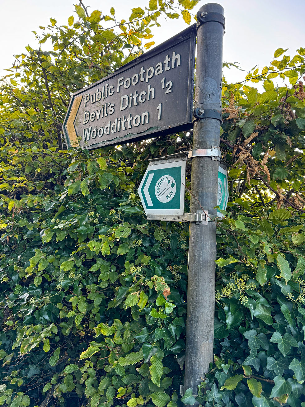
I picked up from where I’d left off the previous week and was soon walking downhill alongside a field in the direction of Woodditton. At the bottom of the hill I passed through a gap in the line of trees at right angles to the path. I didn’t realise at the time that the line of trees was actually encompassing an Anglo Saxon earthwork called the Devil’s Ditch (or Dyke). The ditch clearly wasn’t that deep at the point the path crossed as even I would have taken notice!

The other side of Devil’s Ditch opened up into a large field that the path went through the middle of. Reminding me that this was still horseracing country, I soon passed some horses in training at Church Hall Farm stud, part of the Godolphin racing empire.


Continuing across the countryside for another mile I entered the village of Cheveley, home to more stud farms.


At a gap between two houses in the High Street, the path took a right and continued for a mile into Ashley, a pretty village complete with pond and thatch roofed cottages.


The path now continued along Gazely Road towards the River Kennett, passing into Suffolk as it crossed the B1085 road. A little further on and the path turned right to walk alongside the Kennett for about a mile, eventually crossing it into the village of Dalham.


Almost immediately I came across a strange construction, looking like a beehive, alongside the road. This was a malt kiln, one of only two remaining standing in Suffolk. As such it has been Grade II listed. The kiln was probably built in the early Victorian era. Malt kilns were used to dry partially germinated barley, stopping it from further germination in order to create malt. Malt is used in the production of beer and whisky and the kiln was the final stage in its creation. These days, malt is created on an industrial scale but still using the same basic techniques.


Opposite the kiln, the Icknield Way left the road and headed up a short but steep (well, for this part of the country!) path towards the church. Looking at the colours of the leaves on some of the trees it was hard to believe we were still in August.


At the top of the path I could see the church as well as Dalham Hall. Until 1955 the hall had three stories but a fire in that year destroyed the third floor and this wasn’t reinstated when the building was repaired. Having seen a photo of the hall before the fire, it certainly looks more in proportion and better looking without that third floor!
Since 2009, the hall and its 3300 acre estate have been owned by Sheikh Mohammed bin Rashid Al Maktoum, the Ruler of Dubai and Vice President and Prime Minister of the UAE. Sheikh Mohammed had already bought Dalham Hall Stud on the estate in 1981. The stud is the headquarters of Darley, the name of his global thoroughbred breeding operation. Darley is itself part of Godolphin, Sheikh Mohammed's global thoroughbred breeding & horseracing stable, also headquartered at Dalham.


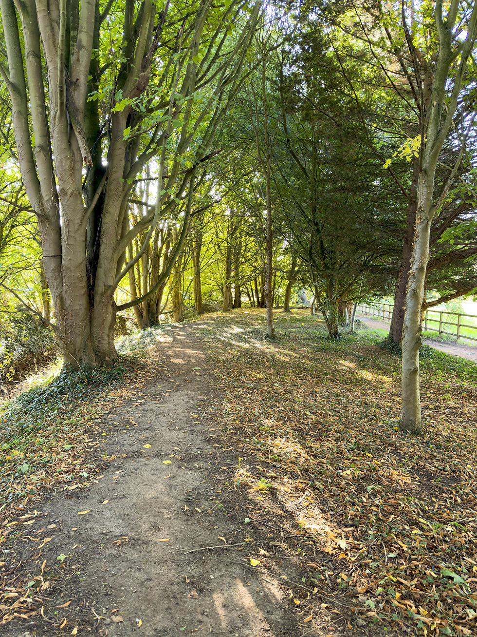
Anyway, there was very little I could see of Dalham Hall as the trail skirted all around it through some wooded areas before opening up alongside fields.


After about 20 minutes I emerged into the village of Gazeley. The village has a population of about 700 people. Local folklore has it that the village is so called because ‘It gazes over Ely’. In fact, the name is of Anglo Saxon origin – Gaseleia but Ely Cathedral can apparently be clearly seen on the horizon on a clear day from the highest point on Moulton Road. Yet again, my walks are such a learning experience!


After passing the Grade I listed church, the path began a slow descent towards the A14 along a very quiet road in the direction of Kentford. At the next fork in the road I bore right onto the road signposted to Needham Street. Again, the road was very quiet and after a while I could leave the road and continue alongside a field.


Eventually, I reached and crossed the B1506 and then crossed the A14 by way of a tunnel under the busy road. Thankfully I had no narrow footbridges to walk over!


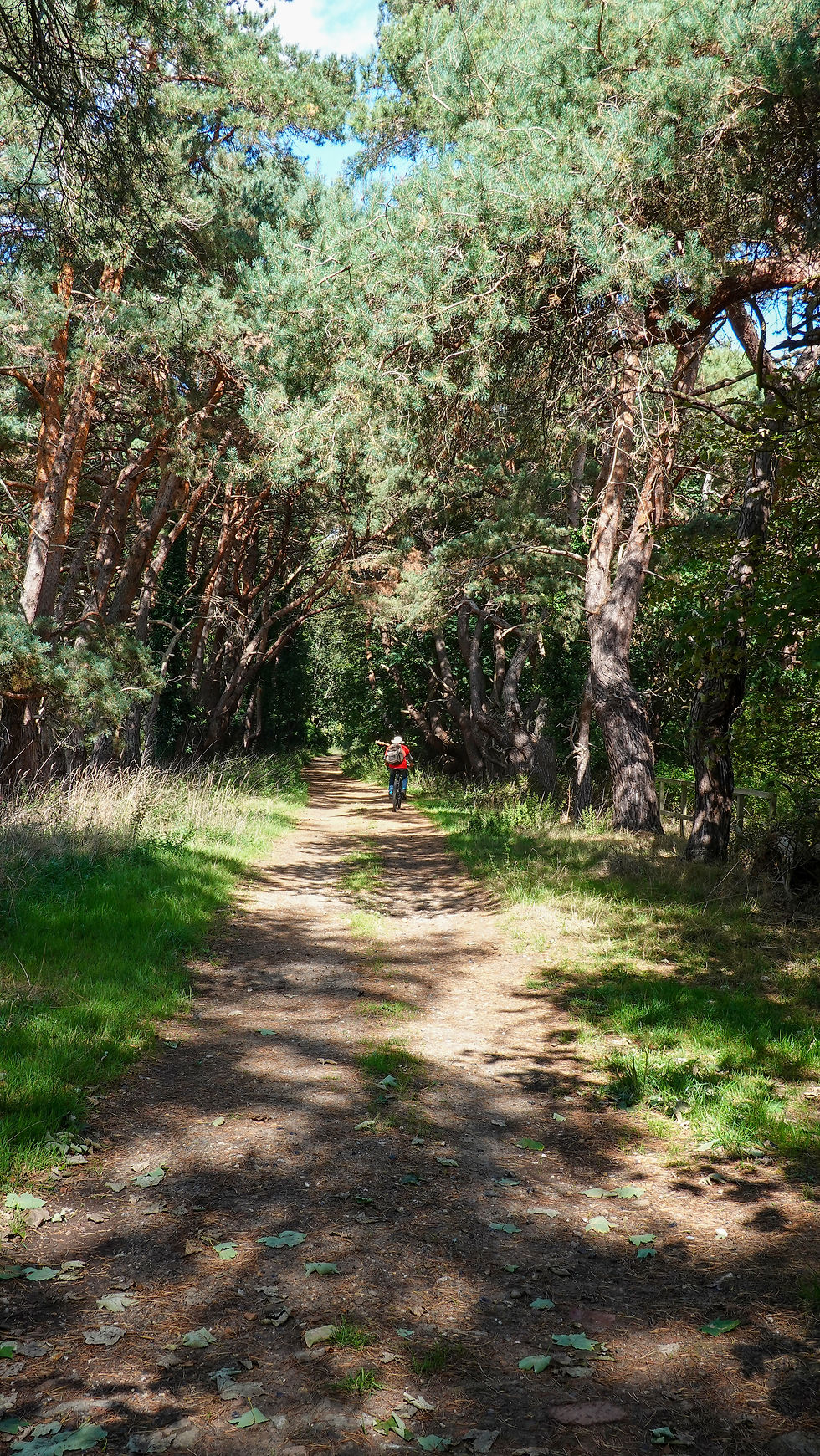
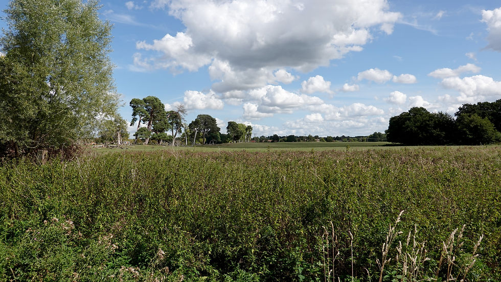
I immediately passed what I thought must be a cement works but on closer inspection it was actually one half of Phoenix Works Bike Park; the other half was on the other side of the A14. After passing under a railway bridge, the next almost four miles weren’t the most exciting, with a lot of walking along paths with trees on both sides; at least it was all downhill. I passed through the tiny village of Herringswell before eventually reaching Tuddenham.


RAF Tuddenham was built in 1941 with a runway long enough to handle bombers. In the middle of the green at Tuddenham is a War Memorial which is dedicated to all those who served their country as members of XC Squadron. The squadron was also known as 90 Squadron and was based for a time at RAF Tuddenham.


Just past the green I walked past the Purple Pantry - a farm shop and café. Just a little further on I passed a turkey farm with the birds free to roam.


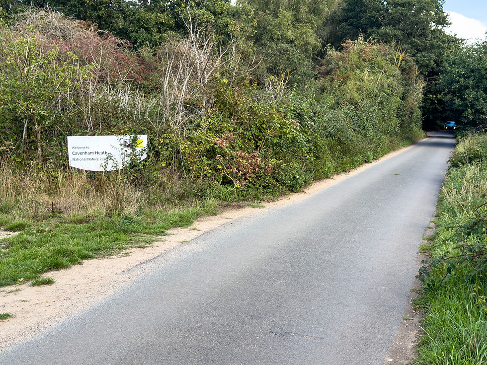
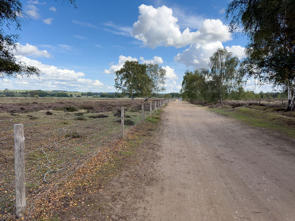
Beyond the farm, the path continued along a dead straight, single-track road which eventually turned into a dirt track, to reach Cavenham Heath National Nature Reserve. The reserve covers about 500 acres and is a great example of Breck Heathland. In addition, it has riverside meadows, woodland, wet woodland scrub and small areas of fen. It is noted for its rare breeding birds, particularly the Stone Curlew.


The trail continued along the dirt track before reaching a bridge over the River Lark. After crossing the river, the path continued for about ½ mile before emerging onto a residential street in Icklingham.

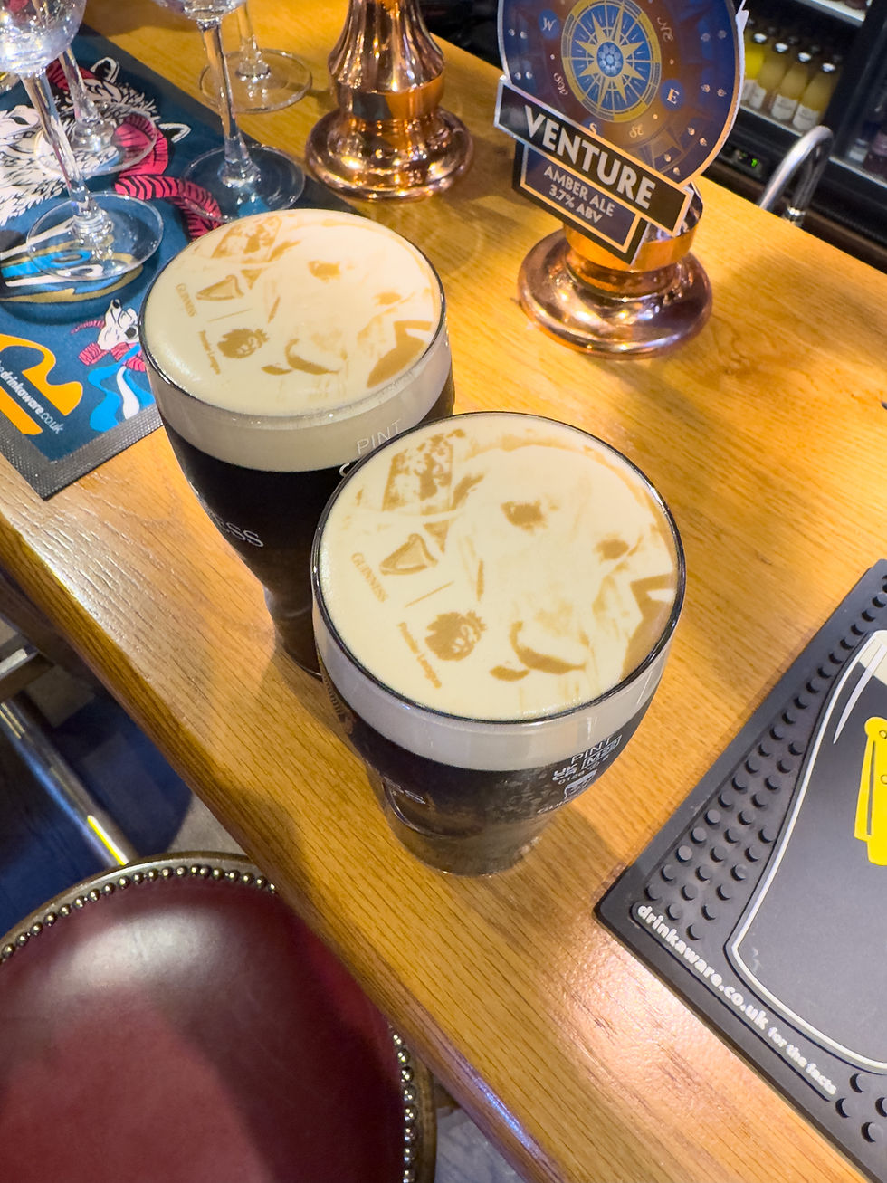
I walked past the church and along the main road to the bus stop referred to as ‘Icklingham - The Street - Red Lion’. The Red Lion was a pub that closed in 2011 and lay empty for a number of years until the current owners, the Elveden Estate, bought it, spent £2 million on refurbishing it and then reopened it in 2019 as The Guinness Arms. It looked so attractive and welcoming from the bus stop. As my bus back to Newmarket wasn’t due for another 30 minutes, I decided to pop in for a quick pint. It was certainly as welcoming inside as it looked from the outside. I’d quite like this as my local!


The number 16 bus back to Newmarket arrived on time. It took almost an hour from Icklingham but this really didn’t bother me, as I sat on the top deck admiring the countryside on a lovely late summer afternoon. I was now just one stage from completing the Icknield Way Path.


Comments