Stage 33 - Wessex Ridgeway - Devizes to Avebury - April 5th 2026

Updated: Aug 13
Official Stage Statistics
Route distance – 11.74 miles
Duration - 4 hours 44 mins
Total ascent – 986 feet
Total descent –931 feet
Highest point – 850 feet

Logistics
Drive to National Trust Avebury car park and park car
Catch bus 49 from opposite Red Lion pub to Devizes
Walk to Avebury, pick up car & drive to Premier Inn Swindon Town Centre
My Walk
In terms of history, today’s walk starting from Devizes would take in an Iron Age hillfort on Roundway Down, a Roman road, another ancient hillfort at Cherhill Down along with a 246 year old chalk horse and all this before reaching Avebury. The Wessex Ridgeway (WR) is the only one of the six trails comprising the Great Chalk Way that actually passes Avebury, a World Heritage Site that contains an extraordinary cluster of Neolithic and Bronze Age monuments.

My walk began with a drive from home to the National Trust car park at Avebury. Despite it being a Sunday and Easter Sunday at that, the 49 bus to Devizes was operating from the bus stop opposite the Red Lion pub. The bus only takes 30 minutes and by midday I was in Devizes town centre just as it had stopped raining and the sun was coming out. It wasn’t desperately warm and there was quite a wind blowing.

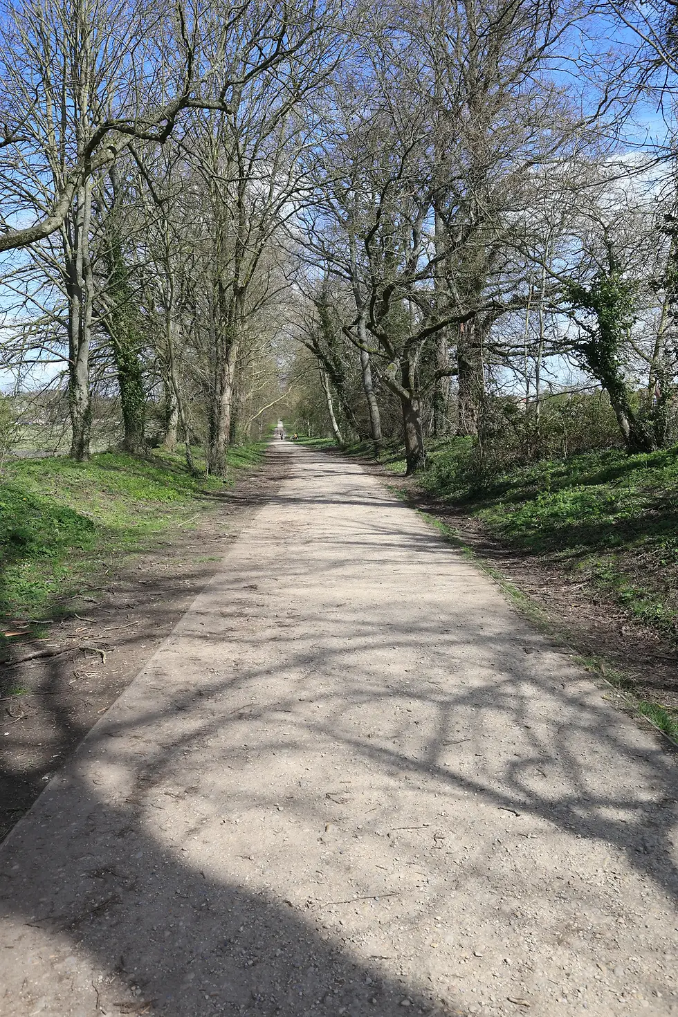
I walked along London Road to the point where it crossed the Kennet & Avon Canal and joined the WR here. At the first bridge I came to, the WR left the canal and crossed the bridge, joining Quakers Walk. Quakers Walk is an attractive, dead-straight, tree-lined footpath.


At the end of the path, the trail continued alongside a field into the hamlet of Roundway, where a diversion forced me onto the steep road up Roundway Hill. The reason for the diversion is the project to bury almost 3 miles of existing electrical power lines and therefore remove a number of pylons from the area. It is one of five projects under National Grid’s Visual Impact Provision scheme to reduce the visual impact of high voltage power lines in protected areas across England and Wales. The works are expected to be completed by the end of 2026. I can certainly forgive the diversion for such a worthy cause!!


Near the top of the hill the road forked right towards the Devizes White Horse – officially the Devizes Millennium White Horse. This horse is the youngest of the 8 Wiltshire chalk horses that and was cut in 1999 to celebrate the forthcoming third millennium. Unlike all the others, this horse faces right rather than left and also depicts the horse in motion. His design was based on that of an earlier Devizes White Horse about a mile away. Due to neglect, the original was completely lost from view by the 1920s.


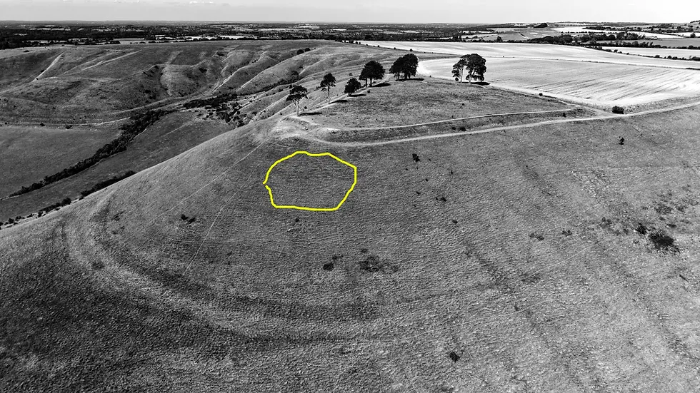
The diverted WR took the left fork in the road rather than the right and soon the curently-closed path up from Roundway rejoined. There were far reaching views of Devizes and beyond. The road became more of a wide, stony track. ½ mile along the track were signs for the WR taking me off to the left and onto Roundway Down Iron Age hillfort. During the English Civil War, the Battle of Roundway Down was fought here in 1643 and today the hillfort is known locally as ‘Oliver's Castle’ or ‘Oliver's Camp’. That said, it appears that Cromwell never camped there; it was one of his generals - Major General William Waller - who actually camped there with his troops. Maybe it should be called Waller's Camp! Anyway, what's important is that this was a beautiful spot with fantastic 360° views.


The wind really picked up after my first drone picture (above) and I had to land it. I really wanted to show just how steep the sides of the hillfort were, so I vowed to return on a calmer day. I therefore returned in August when there was virtually no wind and having had just about no rain in what seemed like forever, the landscape had been transformed from green to brown!
The original Devizes White Horse, historically known as the "Snobs' Horse," was cut into the chalk just below the summit of the hillfort in 1845 by local shoemakers. "Snob" was a regional dialect word for a shoemaker.

The WR continued beyond the hillfort before turning right in the direction of Morgan’s Hill, which with the trees of Furze Knoll on top, together with its 2 radio communications masts, would dominate the landscape for a couple of miles.


Before reaching Morgan’s Hill it was necessary to cross a minor road onto the North Wilts Golf Club. A brief but steepish climb on the golf course brought me to the point where the WR crossed the Wansdyke Path and said goodbye to the Mid Wilts Way, which had been ‘code sharing’ since I left Devizes. 3 miles in the distance the Lansdowne Monument aka the Cherhill Monument came into view for the first time.


The WR skirted around the side of Morgan’s Hill to my right, so not too much to see but to my left I had wonderful views of Cherhill Down – so impressive!


I noticed that the path from Morgan’s Hill was remarkably straight. The OS map has this marked as ‘Roman Road’, so that explains it!

The WR eventually turned off in the direction of Cherhill Down and quickly climbed to the high point of this stage at the top of Cherhill Hill where I found the Lansdowne Monument, the Cherhill White Horse and Oldbury Castle.

The Lansdowne Monument can be seen from miles away. The monument is a 125 foot tall slender stone obelisk built in 1845 by the 3rd Marquis of Lansdowne in memory of his ancestor, Sir William Petty. Petty was a founding member of the Royal Society and the man who, more than anyone, amassed the Lansdowne family fortune. One of his descendants, the 1st Marquis of Lansdowne, served as Prime Minister under King George III.

The Cherhill White Horse was cut into the chalk in 1780 under the direction of Dr Christopher Allsop, a physician from Calne. A local tradition says that Allsop directed the operation by shouting instructions through a large speaking trumpet from a position on the Calne road at the base of the Down!! This horse is the 2nd oldest of the Wiltshire chalk horses after Westbury.


Oldbury Castle is an Iron Age hillfort. It is bivallate, meaning it is defended by a double ditch and bank, except on the north-west side where the steep scarp acts as an additional defence for a single bank and ditch. The fortifications enclose an area of 22 acres and are built across part of an earlier Bronze Age site. As with all hillforts, Oldbury Castle is best viewed from the air. As I pointed out at the beginning, it was a pretty windy day and at the top of the hill it was just too windy for my drone. I therefore returned the following morning when the wind had calmed down to get some drone images and footage.


Needless to say, I got some pretty amazing views from the top of the hill.

After spending about half an hour on the hill I followed the WR down the hill towards the A4. The path turned right shortly before the road onto a grass covered path on what was the Old Bath Road.


At the end of the path was a small car park and gallops. I don’t know who owns the gallops but the owner allows public access from 12:30 onwards after his/her horses have trained.

The path crossed onto the busy A4 road and then continued along a grass verge towards the Beckhampton roundabout.

Shortly before reaching the roundabout the path veered left and continued towards Avebury Trusloe. I passed my first two sarsen stones of the day, known as The Longstones. The larger of the two is named ‘Adam’ and the other, ‘Eve’.

The path crossed the infant River Kennet. The Kennet has its source from a number of springs in the area and eventually joins the River Thames in Reading.

As I crossed the river, Silbury Hill became visible to my right. It’s an amazing sight to see, right by the side of the A4. At 129 feet high, the hill is the tallest prehistoric man-made mound in Europe and one of the largest in the world.

A couple of minutes later I was in the village of Avebury. Avebury itself along with the other sites that make up Avebury World Heritage Site is an unbelievably beautiful and fascinating place to visit. You could easily spend a day visiting all the sites. Avebury village makes a perfect finish to any walk. Not only do you have the stone circles, henge and West Kennet Avenue on your doorstep but you have a museum, local shops, a pub, National Trust café and a 7 days a week bus service! A little further on you have Silbury Hill, West Kennet Long Barrow, the Sanctuary and Windmill Hill, all within walking distance of the village. What a place!


I’ve visited Avebury so many times in the past, so after a quick walk amongst the stones, I had a pint at the Red Lion before returning to my car and driving to the Swindon Town Centre Premier Inn where I was going to stay for a couple of nights.


With all that it has to offer in terms of history, I really feel that Avebury is a much better place to visit than Stonehenge.
The WR would continue from Avebury for just over 6 miles to finish in Marlbrough. It would cross paths with The Ridgeway on Overton Down, about 1½ miles beyond Avebury and this would mark the finish of the alternative Great Chalk Way route between Win Green and Overton.


Comments